| Cemetery Number | WK126 |
| Town | WARWICK |
| Cemetery Name | MAJ GENERAL THOMAS HOLDEN LOT |
| Find A Grave (Opens in New Tab) |
Go to Find a Grave
|
| Graves List | Display Graves List |
| Location | DIVISION ST |
| State | RI |
| Direction | N |
| Pole Number | 94 |
| Distance | 400 |
| Map Number | |
| Page Number | 216 |
| Plat Number | 9 |
| Deed Book | |
| Deed Page | |
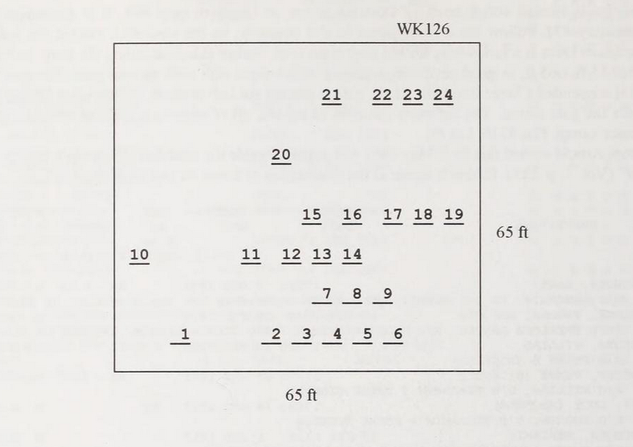
| Size in Feet | 65 |
| Size in Feet | 65 |
| Inscriptions | 24 |
| Fieldstones | 0 |
| Tombs | |
| Exist? | YES |
| Last seen date? | 2013 |
| Newest | 1936 |
| Oldest | 1813 |
| Vandalism | N |
| Veteran | 2 |
| Pole | N |
| Comment | This lot is located 400 ft north of Division Street, at telephone pole #94. It is northwest of East Greenwich historical cemetery #72. Follow the drive adjacent to this cemetery, on the west side, toward the red house. Just before reaching the house there is a fork where the old road turns west. Follow this road (along the stone wall) about 200 ft to the cemetery. It is 65 ft x 65 ft, in good condition, enclosed with a stone wall with an iron gate. The gate has a unique chain from which is suspended a large iron ball. As the gate is opened the ball is lifted, so that upon letting go the gate the ball falls and pulls the gate closed. The cemetery contains 24 burials, all of which are marked with inscribed stones. It is on the tax assessor’s map, Plat #216, Lot #9.
James Arnold visited this lot 2 May 1892 and noted, “Beside the road east of Barton’s corner lot walled and yard in fine order” (Vol. 1, p. 229). Barton’s corner is the intersection of Route #2 and Division Road.
Found, registered and recorded by John Sterling for a book on Warwick cemeteries. |
| Condition | good |
| Enclosure | stone wall |
| Gate | iron gate |
| Growth | overgrown-trees |
| Terrain | level |
| Cemetery Location |
|
| Cemetery Burial Map |
|
| |
|