| Cemetery Number | SK199 |
| Town | SOUTH KINGSTOWN |
| Cemetery Name | DANIEL BRAYMAN LOT |
| Find A Grave (Opens in New Tab) |
|
| Graves List | Display Graves List |
| Location | SOUTH COUNTY TRAIL |
| State | RI |
| Direction | NW |
| Pole Number | 8831 |
| Distance | 2500 |
| Map Number | |
| Page Number | |
| Plat Number | |
| Deed Book | |
| Deed Page | |
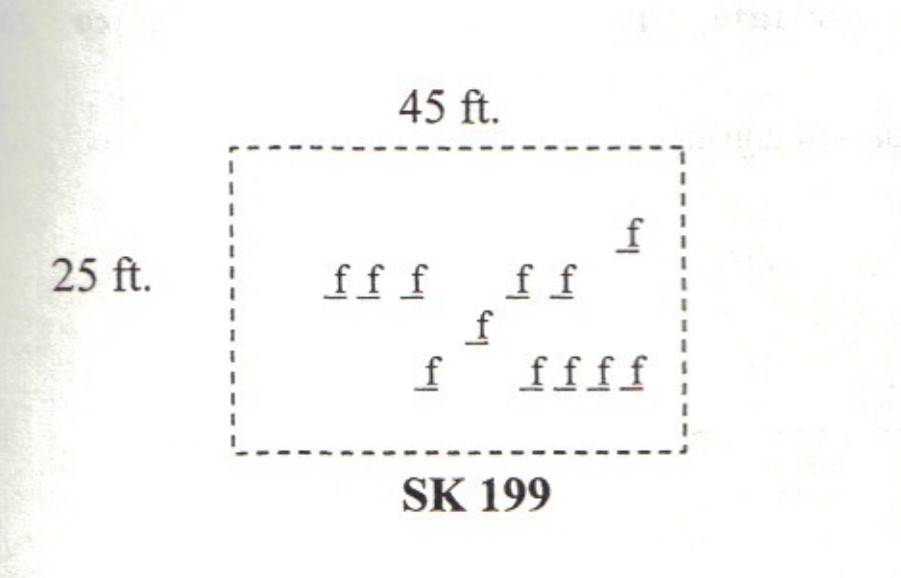
| Size in Feet | 45 |
| Size in Feet | 25 |
| Inscriptions | 2 |
| Fieldstones | 12 |
| Tombs | |
| Exist? | YES |
| Last seen date? | 2003 |
| Newest | |
| Oldest | |
| Vandalism | N |
| Veteran | |
| Pole | N |
| Comment | This cemetery is located 2,500 feet north of South County Trail at telephone pole #8831. It is on the 85 acre farm at 2903 South County Trail. In 2001 this was a llama farm. It is 220 feet southwest of the Brayman family house foundation (41º 29.549' x 71º 35.185'). This house was a way station on the Narragansett Trail, located just off the high point on the trail. Three cemeteries, SK 199, SK 200, and SK 54 are all quite near each other. This cemetery is 45 feet x 25 feet, in good condition, with no enclosure and no historical cemetery sign. There are twelve fieldstone marked graves.
James N. Arnold visited this lot 19 Nov 1880, his #257, “on land of Hiram Doyle near his house a burial yard of the Braman family marked with rude stones.” [Arnold spelled the name Braman not Brayman as on the 1857 Walling map and the 1870 Beers Atlas]
Found, registered, and recorded by John Sterling & James Wheaton for a 2004 book on South Kingstown cemeteries. |
| Condition | good |
| Enclosure | no enclosure |
| Gate | no gate |
| Growth | overgrown-trees |
| Terrain | level |
| Cemetery Location |
|
| Cemetery Burial Map |
|
| |
|