| Cemetery Number | SK103 |
| Town | SOUTH KINGSTOWN |
| Cemetery Name | JEREMIAH BROWN LOT |
| Find A Grave (Opens in New Tab) |
Go to Find a Grave
|
| Graves List | Display Graves List |
| Location | HIGH RIDGE DRIVE |
| State | RI |
| Direction | E |
| Pole Number | |
| Distance | 375 |
| Map Number | |
| Page Number | |
| Plat Number | |
| Deed Book | |
| Deed Page | |
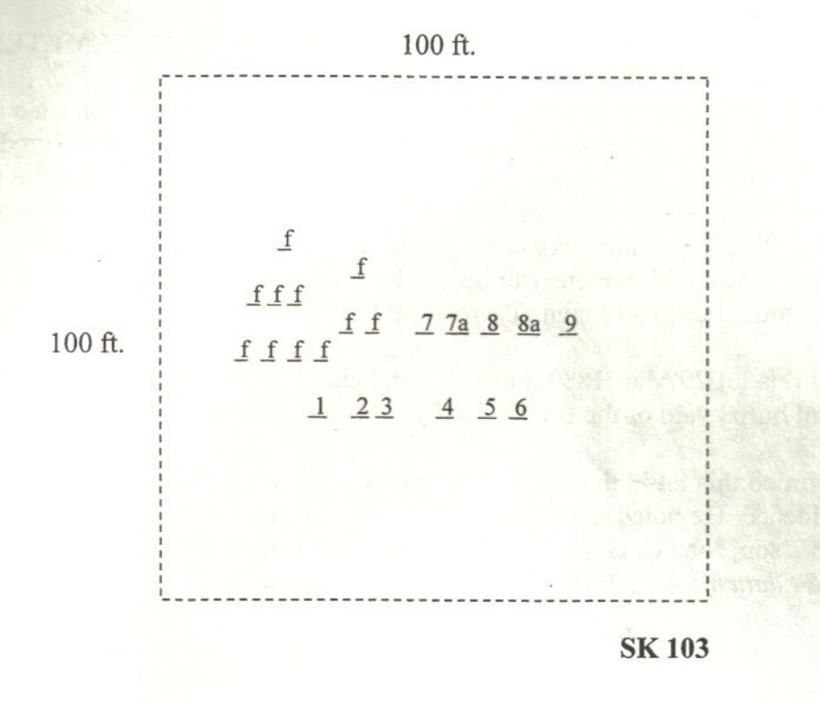
| Size in Feet | 100 |
| Size in Feet | 100 |
| Inscriptions | 8 |
| Fieldstones | 14 |
| Tombs | |
| Exist? | YES |
| Last seen date? | 1998 |
| Newest | 1855 |
| Oldest | 1796 |
| Vandalism | N |
| Veteran | |
| Pole | M |
| Comment | This cemetery is located 375 feet east of the northern end of High Ridge Drive (new in 1998), and fifteen hundred feet east of Tower Hill Road. Go east on Ridge Road, and take the first road on the left and go to the end. Follow the trail here about five hundred feet and then go east to the cemetery which is fifty feet west of a north-south stone wall. You will encounter moderate briars and ticks. The gravestones are within a sixty feet by forty feet rectangle, although a deed map shows the cemetery to be one hundred feet square. It is in fair condition, with no enclosure and no historical cemetery sign. There are 22 burials with eight inscribed stones and fourteen fieldstones.
James N. Arnold visited this lot 29 Mar. 1880, his #73, “on land of Joseph Nickols east of his house and on brow hill is an ancient burial yard of the Brown family.” Arnold gives the names of several burials under unmarked fieldstones.
Benjamin F. Wilbur recorded this lot in the 1930s, a transcript now in the James Arnold collection at the Knight Library in Providence. He noted that Thomas Northup Brown is buried here near his father, based on evidence of Brown’s son, John C. G. Brown, and his nephew, John L. Brown, Jr.
Found, registered, and recorded by John Sterling & James Wheaton for a 2004 book on South Kingstown cemeteries. |
| Condition | fair |
| Enclosure | no enclosure |
| Gate | no gate |
| Growth | overgrown-trees |
| Terrain | level |
| Cemetery Location |
|
| Cemetery Burial Map |
|
| |
|