Rhode Island Historical Cemeteries
Home
Members
Events
Meetings/Minutes
Database
FAQ/Documents
Links
Groups/Associations
Contact
FEATURED CEMETERY PHOTO
Photo/Image Courtesy of Rhode Island Historic Cemetery Volunteers
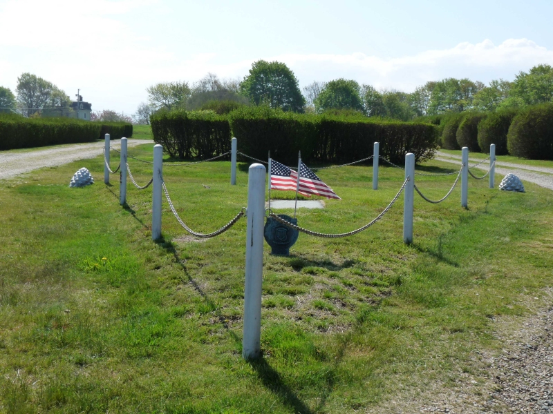
Cemetery Number
NT033
Town
NEWPORT
Cemetery Name
JAHLEEL BRENTON BURIAL GROUND
Find A Grave (Opens in New Tab)
Graves List
Display Graves List
Location
OCEAN DRIVE
State
RI
Direction
W
Pole Number
Distance
2000
Map Number
Page Number
Plat Number
Deed Book
Deed Page
Size in Feet
Size in Feet
Inscriptions
2
Fieldstones
Tombs
Exist?
YES
Last seen date?
Newest
1732
Oldest
1674
Vandalism
Y
Veteran
Pole
N
Comment
This burial ground is next to the Fort Adams Cemetery. The only gravestone there now is that of Jaleel Brenton, son of the Governor. When William Brenton came to New England he carried with him a commission from King Charles I that allowed him to choose a 2000 acre tract of land in Newport that is now called Brenton Point. This is the location of Fort Adams and Governor Brenton's farm called Hammersmith. Governor Brenton's box tomb is no longer there but we have a pretty good description of its purchase by his son Jaleet in the John Stevens account book: Mr. Jaleel Brenton 1727 L S P one double tomb stone for the Governor 45 - 00 - 00 600 bricks at 6 shillings a hundred 01 - 16 - 00 lime 11 bushels 00 - 13 - 09 sand bushels @ 6 a bushel 00 - 04 - 00 two stones for the foundation 00 - 08 - 00 carting the bricks and lime and sand 00 - 07 - 00 carting the tomb stone 01 - 00 - 00 cutting the coate of arms 05 - 10 - 00 building ye boxes 02 - 10 - 00 ______________ 57 - 08 - 09 According to the dates this tombstone was built 53 years after the death of Governor William Brenton. We have never found a recording of it in place so it probably disappeared before 1875 when Richardson was recording the burial grounds in Newport. GPS coordinates (WGS84 datum) 41 deg. 28' 21.24"N x 71 deg. 20' 42.82"W
Condition
fair
Enclosure
metal fence
Gate
no gate
Growth
grass-well kept
Terrain
level
Cemetery Location
Cemetery Burial Map
N/A
ADDITIONAL CEMETERY PHOTOS/MAPS
 Photo/Image Courtesy of Rhode Island Historic Cemetery Volunteers