Rhode Island Historical Cemeteries
Home
Members
Events
Meetings/Minutes
Database
FAQ/Documents
Links
Groups/Associations
Contact
FEATURED CEMETERY PHOTO
Photo/Image Courtesy of Rhode Island Historic Cemetery Volunteers
Cemetery Number
EX033
Town
EXETER
Cemetery Name
DEA SAMUEL SHERMAN LOT
Find A Grave (Opens in New Tab)
Graves List
Display Graves List
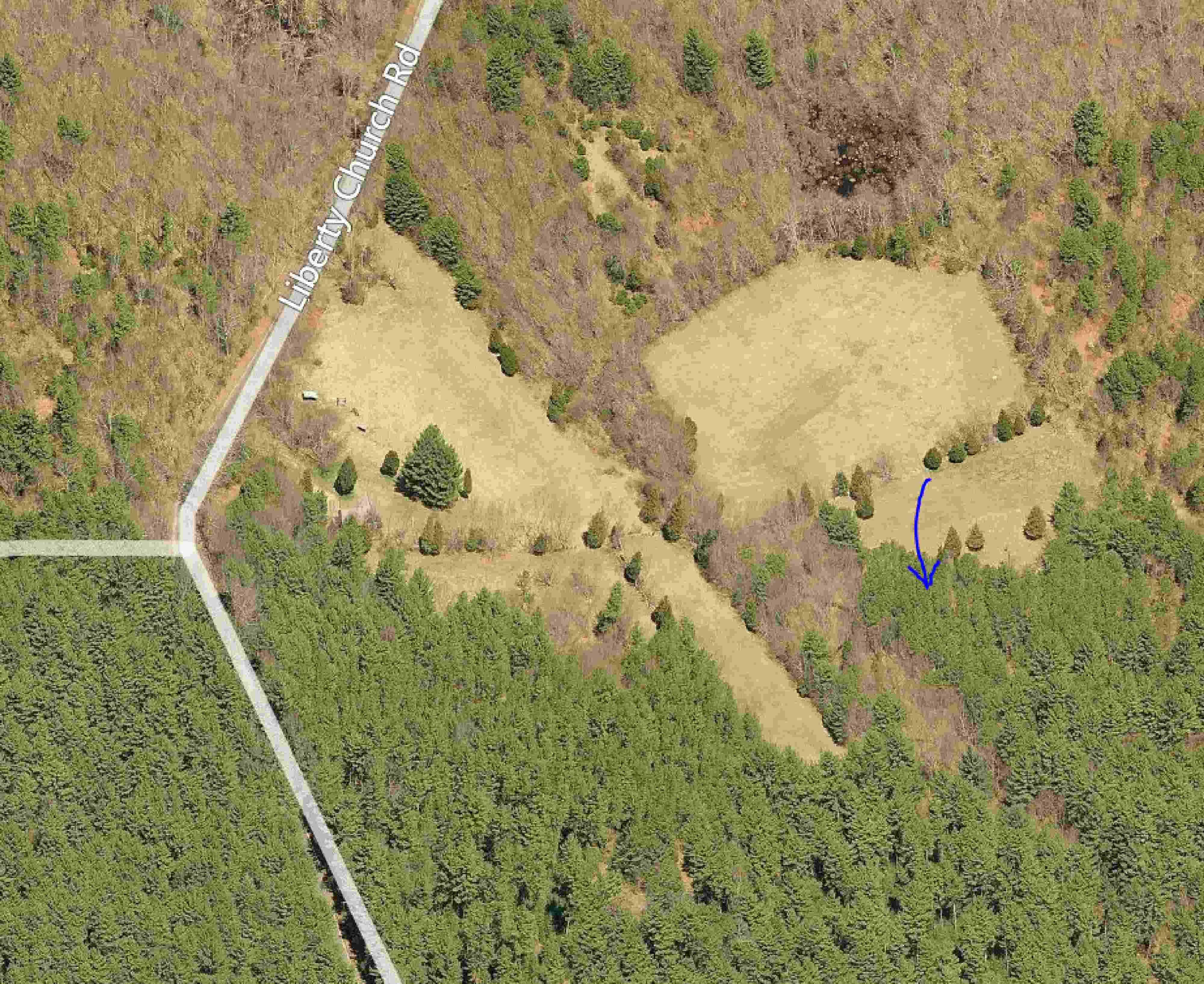
Location
LIBERTY CHURCH RD
State
RI
Direction
E
Pole Number
Distance
900
Map Number
61
Page Number
1
Plat Number
1
Deed Book
Deed Page
Size in Feet
20
Size in Feet
20
Inscriptions
3
Fieldstones
1
Tombs
Exist?
YES
Last seen date?
2013
Newest
1856
Oldest
1843
Vandalism
N
Veteran
0
Pole
N
Comment
Located east of #150 Liberty Church Road. From house [King family, opposite Hog House Hill Rd] go across field down toward the gate at the brook (300 ft). After crossing the brook go slightly SE toward the opening in the stone wall running east (300 ft). From the opening in wall go 225 ft south to the cemetery, which sits against a ston retaining wall running north-south. James Arnold recorded this lot 21 Mar 1880 "lot unprotected in open field a distance north east of the Liberty Meeting House." Recorded by John Sterling & James Good for their 1994 book on Exeter cemeteries.
Condition
fair
Enclosure
no enclosure
Gate
no gate
Growth
overgrown-trees
Terrain
level
Cemetery Location
Cemetery Burial Map
ADDITIONAL CEMETERY PHOTOS/MAPS
 Photo/Image Courtesy of Rhode Island Historic Cemetery Volunteers