Rhode Island Historical Cemeteries
Home
Members
Events
Meetings/Minutes
Database
FAQ/Documents
Links
Groups/Associations
Contact
FEATURED CEMETERY PHOTO
Photo/Image Courtesy of Rhode Island Historic Cemetery Volunteers
Cemetery Number
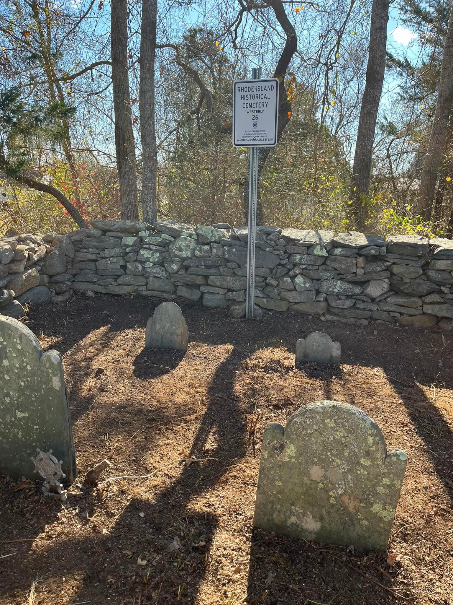
WY026
Town
WESTERLY
Cemetery Name
GOV SAMUEL WARD LOT
Find A Grave (Opens in New Tab)
Go to Find a Grave
Graves List
Display Graves List
Location
SHORE RD & LANGWORTHY ROAD
State
RI
Direction
N
Pole Number
503
Distance
300
Map Number
Page Number
Plat Number
Deed Book
Deed Page
Size in Feet
15
Size in Feet
15
Inscriptions
2
Fieldstones
Tombs
Exist?
YES
Last seen date?
2024
Newest
1774
Oldest
1770
Vandalism
Veteran
Pole
G
Comment
Located 380 feet north of Shore Road and 400 feet east of Langworthy Road. It is behind #302 Shore Road. Can also be reached 200 ft south of the end of ranquility Trail behind new house (1998). Frederic Denison recorded this lot 1867-8 This is north of the shore road on the ancient Ward farm now owned by Albert B Langworthy, Esq, a few rods northwest of the mansion, enclosed by a wall. Can also be reached 200 ft south of the end of Langworth Ct. behind new house (1998).
Condition
good
Enclosure
stone wall
Gate
no gate
Growth
cleared
Terrain
level
Cemetery Location
Cemetery Burial Map
N/A
ADDITIONAL CEMETERY PHOTOS/MAPS
 Photo/Image Courtesy of Rhode Island Historic Cemetery Volunteers