| Cemetery Number | WK021 |
| Town | WARWICK |
| Cemetery Name | THOMAS RICE LOT |
| Find A Grave (Opens in New Tab) |
Go to Find a Grave
|
| Graves List | Display Graves List |
| Location | COMMONWEALTH AVE |
| State | RI |
| Direction | W |
| Pole Number | 20 |
| Distance | 20 |
| Map Number | |
| Page Number | 247 |
| Plat Number | 35 |
| Deed Book | |
| Deed Page | |
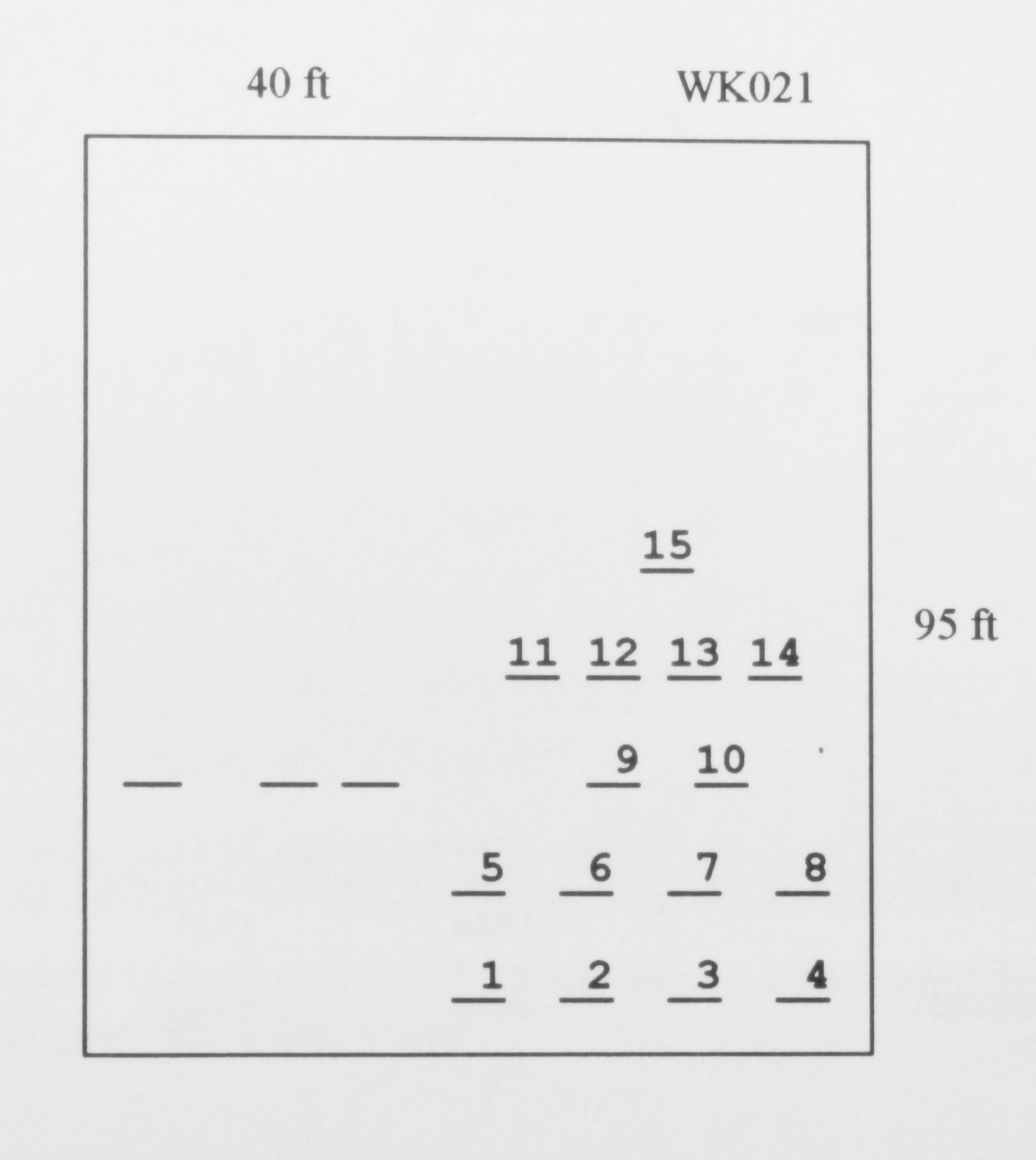
| Size in Feet | 40 |
| Size in Feet | 95 |
| Burials | 18 |
| Inscriptions | 15 |
| Fieldstones | 3 |
| Tombs | |
| Exist? | YES |
| Last seen date? | 2013 |
| Newest | 1881 |
| Oldest | 1797 |
| Vandalism | N |
| Veteran | 0 |
| Pole | F |
| Comment | This cemetery is located 20 ft west of Commonwealth Avenue at telephone pole #20. The cemetery is 40 ft x 95 ft, in fair condition, enclosed with a stone wall. The sign is in fair condition. There are 18 burials with 15 inscribed stones and three fieldstones. It is on the tax assessor’s map Plat #247, Lot #35.
James Arnold visited this lot 30 Oct. 1892 and noted, “on the Emanuel Rice farm, beside the road, well walled, in fine condition” (Vol. 3, p. 358). It was recorded again by Grace Tillinghast and Emma B. Shaw in 1927 (Vol. 29, p.232). Charles and Martha Benns recorded it in 1935, their #381.
Recorded by John Sterling for a book on Warwick cemeteries. |
| Condition | poor |
| Enclosure | stone wall |
| Gate | iron gate |
| Growth | overgrown-briars |
| Terrain | hilly steep |
| Cemetery Location |
|
| Cemetery Burial Map |
|
| |
|