Rhode Island Historical Cemeteries
Home
Members
Events
Minutes
Database
FAQ/Documents
Links
Groups/Associations
Contact
FEATURED CEMETERY PHOTO
Photo/Image Courtesy of Rhode Island Historic Cemetery Volunteers
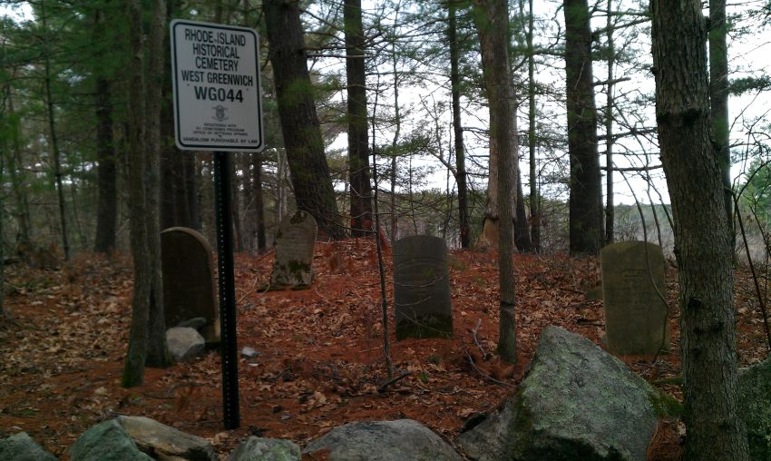
Cemetery Number
WG044
Town
WEST GREENWICH
Cemetery Name
SOLOMON WHITFORD LOT
Find A Grave (Opens in New Tab)
Go to Find a Grave
Graves List
Display Graves List
Location
HENRY BROWN ROAD
State
RI
Direction
Pole Number
Distance
Map Number
Page Number
Plat Number
Deed Book
Deed Page
Size in Feet
35
Size in Feet
35
Burials
20
Inscriptions
4
Fieldstones
Tombs
Exist?
YES
Last seen date?
2015
Newest
Oldest
Vandalism
Veteran
0
Pole
Comment
0.8 miles west of Hopkins Hill Road there is a trail running north into the Nature Conservancy. There is a sign on a tree identifying this trail. Proceed on this looping trail for 1570 feet until the trail ends at a road. Turn right onto this road and go NW 720 feet over a causeway and ford. The cemetery is on the other side on the right. Blanche Albro recorded this cemetery in the 1970s and described it as "1/2 mile behind Harrington saw mill." The 1973 state registration list describes it as "in front of NEL pole #22 on Henry Brown Road, 1/2 mile in on a Sawmill Road, on the right hand side. Barbed wire fence and wooden gate." Within Big River Reservoir area. On their map it is shown south of Congdon Mill Road about 1/4 mile west of New London Turnpike. GPS coordinates 41 deg. 36' 50.20"N x 71 deg. 35' 07.61"W
Condition
fair
Enclosure
metal fence
Gate
wooden gate
Growth
cleared
Terrain
hilly moderate
Cemetery Location
Cemetery Burial Map
N/A
ADDITIONAL CEMETERY PHOTOS/MAPS
 Photo/Image Courtesy of Rhode Island Historic Cemetery Volunteers