| Cemetery Number | SM089 |
| Town | SMITHFIELD |
| Cemetery Name | ROBERT HARRIS LOT |
| Find A Grave (Opens in New Tab) |
Go to Find a Grave
|
| Graves List | Display Graves List |
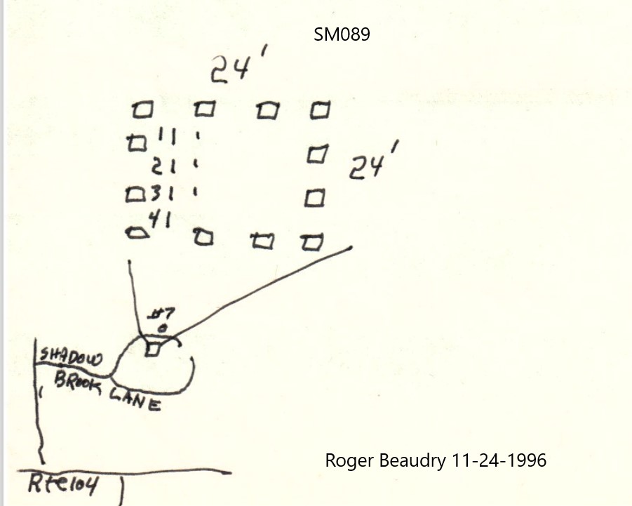
| Location | SHADOWBROOK LANE |
| State | RI |
| Direction | N |
| Pole Number | 7 |
| Distance | 30 |
| Map Number | |
| Page Number | |
| Plat Number | |
| Deed Book | |
| Deed Page | |
| Size in Feet | 24 |
| Size in Feet | 24 |
| Inscriptions | 5 |
| Fieldstones | |
| Tombs | |
| Exist? | YES |
| Last seen date? | |
| Newest | 1934 |
| Oldest | 1875 |
| Vandalism | N |
| Veteran | |
| Pole | N |
| Comment | Transcribed by Ethel M White March 23, 1937, who described it as follows:
"Junction of Pleasant View Ave (old Greenville Rd) Route #5 - straight ahead to Woonsocket turn right on road to Lincoln Woods"
Transcribed by Grace G Tillinghast Oct 8, 1930, (Vol 25, page 413). She described lot as follows:
"Left hand side of Farnum Pike on Harris farm. Farm house faces on Spragueville Road."
Transcribed by Charles & Martha Benns #226 (Vol II, page 225). They described lot as follows:
"Harris family near Farnum Pike & Greenville Ave, Smithfield"
Transcribed by Ron Farrar whio described lot as follows:
"Shadowbrook, corner 116 & 5, Stump Pond"
Transcribed and registered by Roger Beaudry November 24, 1996. |
| Condition | good |
| Enclosure | granite posts |
| Gate | no gate |
| Growth | overgrown-weeds |
| Terrain | hilly moderate |
| Cemetery Location |
|
| Cemetery Burial Map |
|
| |
|