Rhode Island Historical Cemeteries
Home
Members
Events
Meetings/Minutes
Database
FAQ/Documents
Links
Groups/Associations
Contact
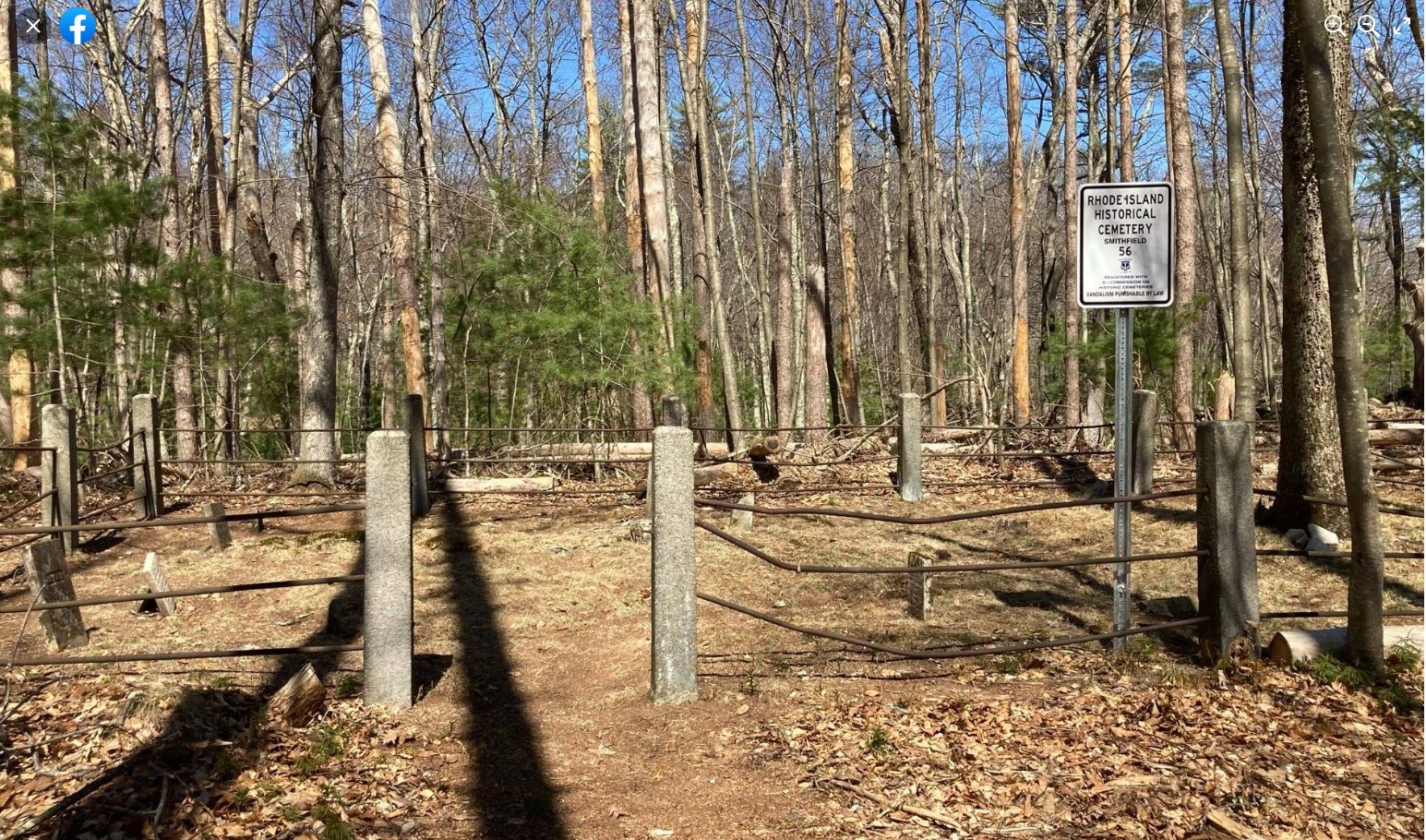
FEATURED CEMETERY PHOTO
Photo/Image Courtesy of Rhode Island Historic Cemetery Volunteers
Cemetery Number
SM056
Town
SMITHFIELD
Cemetery Name
WILLIAM MOWRY LOT
Find A Grave (Opens in New Tab)
Go to Find a Grave
Graves List
Display Graves List
Location
ROCKY HILL ROAD
State
RI
Direction
E
Pole Number
37
Distance
715
Map Number
Page Number
Plat Number
Deed Book
Deed Page
Size in Feet
40
Size in Feet
24
Inscriptions
8
Fieldstones
2
Tombs
Exist?
YES
Last seen date?
Newest
1857
Oldest
1821
Vandalism
Y
Veteran
Pole
M
Comment
Transcribed by James N Arnold Oct 18, 1891 (Vol 25, pp390-392). He describes lot as follows: "On the William Mowry Esq farm once owned by William A Howard. Lot protected by iron rails and granite posts. Yard neglected." Transcribed by Ethel M White(March 23, 1937) who described it as: "Continuing along Reservoir Ave brings one out on Rockey Hill Road Smithfield - right where the old jail stands (Old State Farm). On this road is the Mowry barn and corn crib remains. Once a very large farm and Mowry house foundation. Cemetery near Reservoir, Woonsocket Water Dept." Transcribed by Irene Nebiker during the early 1970's. Transcribed by Ron Farrar who described lot as follows: "Rocky Hill Rd, S.E. of Tobin Farm next to reservoir" Transcribed by Roger Beaudry Feb 7, 1998. Cemetery can be found by travelling 3/10 of a mile past telephone pole #37. On right is a path which leads to the Woonsocket Reservoir. Follow path about 200 ft and take fork to the right. Travel down to the water past an old corn crib and foundation to the cemetery. Lot is in deplorable condition. All engraved stones have been broken and scattered about.
Condition
very poor
Enclosure
granite posts/iron rails
Gate
gate missing
Growth
overgrown-weeds
Terrain
level
Cemetery Location
Cemetery Burial Map
ADDITIONAL CEMETERY PHOTOS/MAPS
 Photo/Image Courtesy of Rhode Island Historic Cemetery Volunteers