| Cemetery Number | SM043 |
| Town | SMITHFIELD |
| Cemetery Name | BARNES-SMITH LOT |
| Find A Grave (Opens in New Tab) |
Go to Find a Grave
|
| Graves List | Display Graves List |
| Location | MOUNTAINDALE ROAD |
| State | RI |
| Direction | S |
| Pole Number | 15 |
| Distance | 680 |
| Map Number | |
| Page Number | |
| Plat Number | |
| Deed Book | |
| Deed Page | |
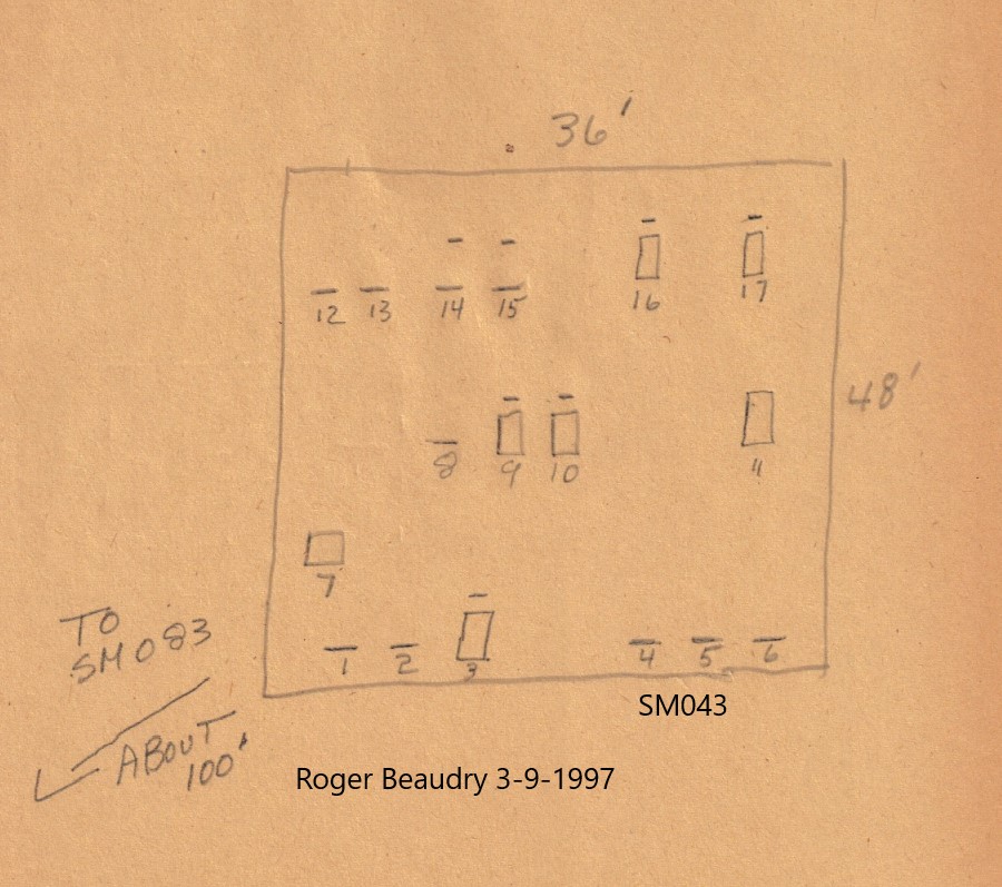
| Size in Feet | 36 |
| Size in Feet | 48 |
| Inscriptions | 17 |
| Fieldstones | |
| Tombs | |
| Exist? | YES |
| Last seen date? | 2015 |
| Newest | 1923 |
| Oldest | 1846 |
| Vandalism | Y |
| Veteran | |
| Pole | F |
| Comment | This cemetery is behind the northwest corner of the Smithfield Crossings shopping center (built about 2003), below the retaining wall. It is 1235 feet west of the bridge for the southbound lanes of Route #I-295 over Mountaindale Road. It is 680 feet south of Mountaindale road.
Transcribed by James N Arnold August 28, 1919 (Vol 25 pp 113-116). He discribes it as follows:
"On the Old Barnes Place, back from Wolf Hill Rd, west side on edge of wood. This burial yard is well fenced with pickets, well painted, granite posts, yard in fair order."
Transcribed by Ethel M. White May 21, 1939. She describes it as: "Peter Barnes Homestead, 1700. Bought from Jonathan Salisbury 1823-24. Wolf Hill Road - sometimes called Mountaindale Road, Esmond, leads from Sebille Road. White picket fence surrounding cemetery well kept. Mr E.T. Lawton - Box 40 RFD is living on farm."
Transcribed by Ron Farrar who describes it as "Mountaindale Road"
Transcribed by Roger Beaudry March 9, 1997. Lot is in very poor condition. The wooden fence surrounding lot is all but rotted away. Many stones are down. Lot is to the right of field about 1500 feet behind NEL 15. |
| Condition | poor |
| Enclosure | wood fence |
| Gate | gate missing |
| Growth | overgrown-trees |
| Terrain | level |
| Cemetery Location |
|
| Cemetery Burial Map |
|
| |
|