| Cemetery Number | SM025 |
| Town | SMITHFIELD |
| Cemetery Name | RICHARD SWEET LOT |
| Find A Grave (Opens in New Tab) |
Go to Find a Grave
|
| Graves List | Display Graves List |
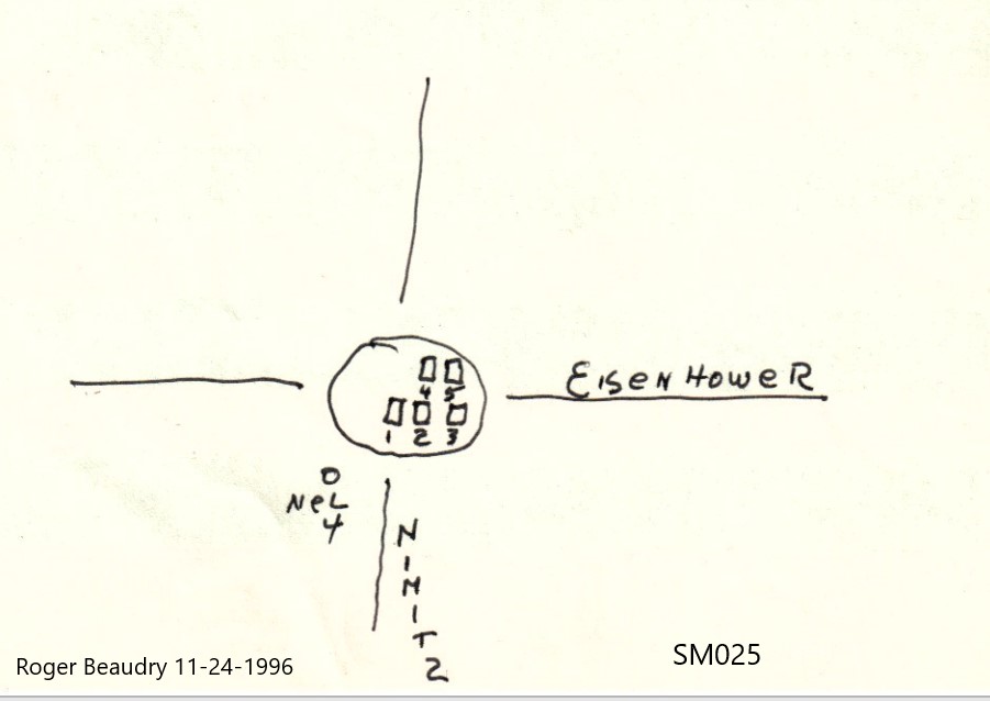
| Location | NIMITZ ROAD (AT INTERSECTION W/EISENHOWER RD) |
| State | RI |
| Direction | |
| Pole Number | 4 |
| Distance | |
| Map Number | |
| Page Number | |
| Plat Number | |
| Deed Book | |
| Deed Page | |
| Size in Feet | |
| Size in Feet | |
| Inscriptions | 5 |
| Fieldstones | |
| Tombs | |
| Exist? | YES |
| Last seen date? | 2012 |
| Newest | 1885 |
| Oldest | 1841 |
| Vandalism | N |
| Veteran | |
| Pole | M |
| Comment | Transcribed by James N Arnold (Vol 25, pp328-329). He describes lot as follows:
"On the Richard Sweet place at Spragueville, back and in sight of the road and between it and the Reservoir, burial yard of his family, yard fenced with granite posts, wooden pickets, poor order, yard the same."
Grace G Tillinghast (Vol 25, page 329) transcribed one stone.
Transcribed by Ethel M White March 2, 1937. "Pleasant View Ave, small cemetery on farm of Henry A White."
Transcribed by Charles & Martha Benns (Vol II, page 201). They assigned it #188 and described it as "in Smithfield at Spragueville"
Two stones were transcribed by Ron Farrar but were mistakenly assigned to SM076.
Transcribed by Roger Beaudry November 24, 1996. Lot is located on a traffic island at the intersection of Nimitz & Eisenhower Rd. The island is approximately 29' in diameter and completely open. No posts or enclosure of any kind is visible. All stones are lying face up, and may have been put this way purposely for safety reasons. |
| Condition | good |
| Enclosure | no enclosure |
| Gate | no gate |
| Growth | grass-well kept |
| Terrain | level |
| Cemetery Location |
|
| Cemetery Burial Map |
|
| |
|