| Cemetery Number | SK156 |
| Town | SOUTH KINGSTOWN |
| Cemetery Name | CHAMPLAIN - HOLLAND LOT |
| Find A Grave (Opens in New Tab) |
|
| Graves List | Display Graves List |
| Location | ROUTE #1 - POST RD |
| State | RI |
| Direction | SE |
| Pole Number | |
| Distance | 125 |
| Map Number | |
| Page Number | |
| Plat Number | |
| Deed Book | |
| Deed Page | |
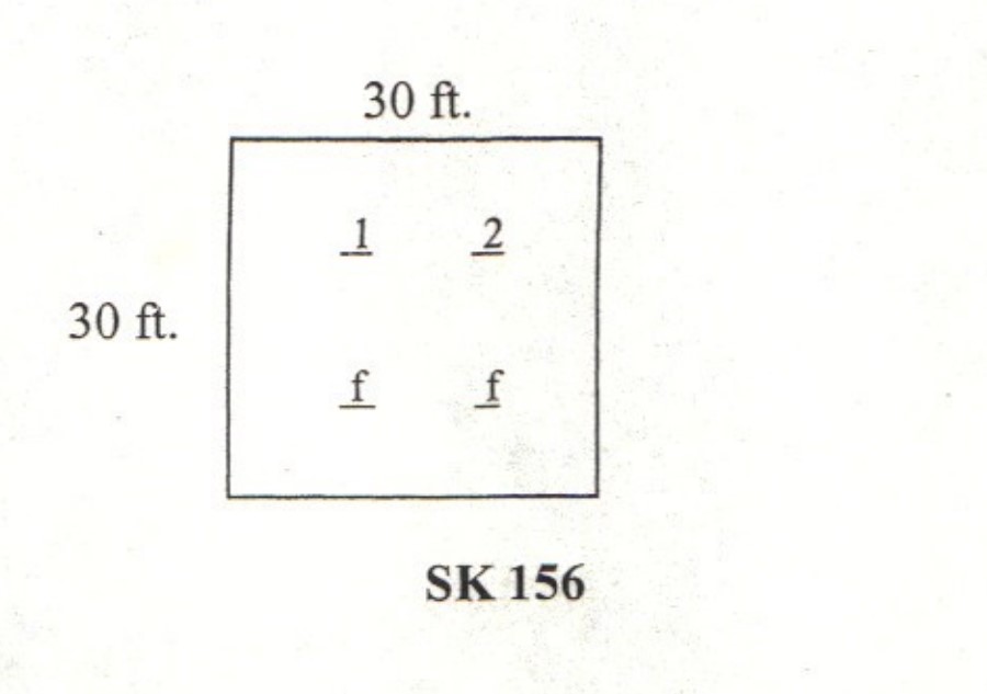
| Size in Feet | 30 |
| Size in Feet | 30 |
| Inscriptions | 5 |
| Fieldstones | 2 |
| Tombs | |
| Exist? | YES |
| Last seen date? | 2003 |
| Newest | 1887 |
| Oldest | 1849 |
| Vandalism | N |
| Veteran | 0 |
| Pole | N |
| Comment | This cemetery is located 125 feet southeast of Route #1 - Post Road and east of the Commodore Perry Homestead. To get to it leave Post Road, about one hundred feet west of the sign for Old Post Road south and find the stone wall running north-south. Follow this wall about one hundred feet to a cross wall. The cemetery is at the northeast corner of this wall intersection. It has stone walls on the north and west sides and is thirty feet square. This lot, heavily overgrown with briars and brush, is in poor condition, and it has no historical cemetery sign. In 1880 James N. Arnold found four inscribed stones (Sarah Holland was living then), and six unmarked graves, but today there are only two inscribed stones and two fieldstones, the Champlins having been moved to Oakdell Cemetery, SK037.
James N. Arnold visited this lot Oct. 19, 1880 and numbered it #198. He described it “on the land of [blank] in corner of lot partly fenced partly walled, a burial yard in good condition.”
Found, registered, and recorded by John Sterling & James Wheaton for a 2004 book on South Kingstown cemeteries. |
| Condition | poor |
| Enclosure | stone wall |
| Gate | no gate |
| Growth | overgrown-trees |
| Terrain | level |
| Cemetery Location |
|
| Cemetery Burial Map |
|
| |
|