| Cemetery Number | SK151 |
| Town | SOUTH KINGSTOWN |
| Cemetery Name | WATSON LOT |
| Find A Grave (Opens in New Tab) |
|
| Graves List | Display Graves List |
| Location | ROUTE #138 |
| State | RI |
| Direction | N |
| Pole Number | 3593 |
| Distance | 200 |
| Map Number | |
| Page Number | |
| Plat Number | |
| Deed Book | |
| Deed Page | |
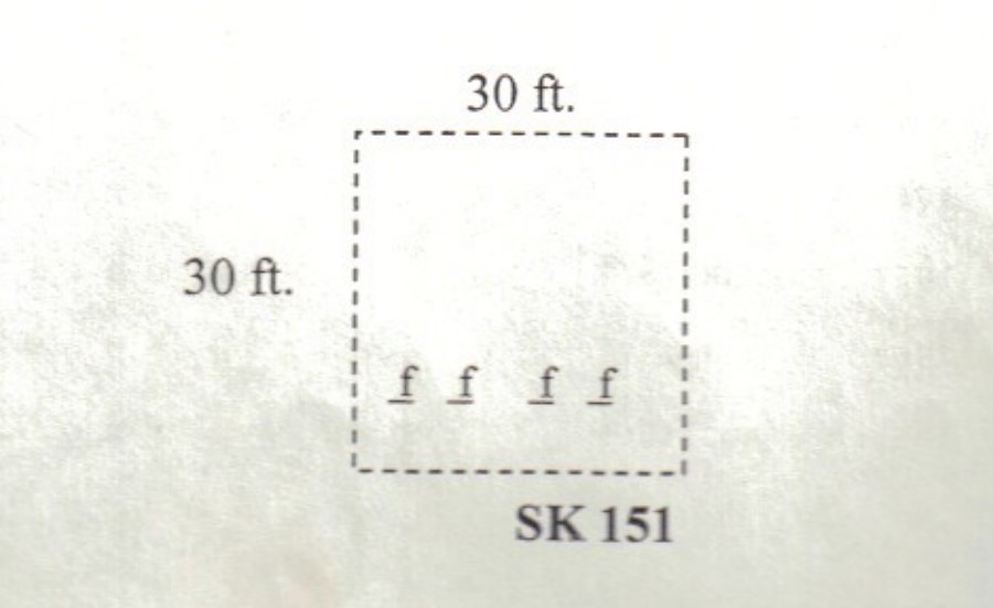
| Size in Feet | 30 |
| Size in Feet | 30 |
| Inscriptions | 0 |
| Fieldstones | 4 |
| Tombs | |
| Exist? | YES |
| Last seen date? | 2003 |
| Newest | |
| Oldest | |
| Vandalism | N |
| Veteran | |
| Pole | N |
| Comment | This cemetery is located two hundred feet north of Mooresfield Road (Route #138) at telephone pole #3593, and 75 feet west of the Palmer Gardner House (527 Mooresfield Road) along the back line of the house and over the wall. It is thirty feet square, in fair condition, with no enclosure except for a stone wall on the east side, and no historical cemetery sign. There are four fieldstone-marked burials. We are told in the Pettaquamscutt Historical Society book that one of them is Jeffrey Watson, former town clerk of South Kingstown. A transcription of his diary by Marjorie W. Schunke was published in the Rhode Island Genealogical Register, Vol. 3, No. 3 (July 1980), pp. 1-17.
Found, registered, and recorded by John Sterling & James Wheaton for a 2004 book on South Kingstown cemeteries. |
| Condition | fair |
| Enclosure | no enclosure |
| Gate | no gate |
| Growth | overgrown-trees |
| Terrain | level |
| Cemetery Location |
|
| Cemetery Burial Map |
|
| |
|