| Cemetery Number | SK137 |
| Town | SOUTH KINGSTOWN |
| Cemetery Name | THOMAS WEBSTER LOT |
| Find A Grave (Opens in New Tab) |
Go to Find a Grave
|
| Graves List | Display Graves List |
| Location | SAND PLAIN RD |
| State | RI |
| Direction | N |
| Pole Number | 6590 |
| Distance | 1270 |
| Map Number | |
| Page Number | |
| Plat Number | |
| Deed Book | |
| Deed Page | |
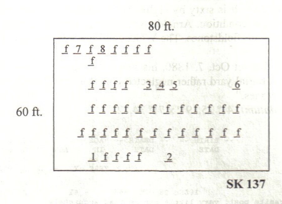
| Size in Feet | 60 |
| Size in Feet | 80 |
| Inscriptions | 9 |
| Fieldstones | 47 |
| Tombs | |
| Exist? | YES |
| Last seen date? | 2003 |
| Newest | 1846 |
| Oldest | 1815 |
| Vandalism | N |
| Veteran | |
| Pole | G |
| Comment | This cemetery is located on land of the Worden Pond Family Camp Ground. It can be reached from Sand Plain Road or through the back side of the campground. From Sand Plain Road enter opposite telephone pole #6590 and go north 1,270 feet. It is sixty by eighty feet, in fair condition, with no enclosure. The historical cemetery sign is in good condition. Arnold counted sixty marked graves. In 2001 48 of these were found, all but one marked with fieldstones. The Wells child has a marble stone, and there are seven crudely inscribed fieldstones.
James N. Arnold recorded this lot Oct. 7, 1880, his #142, “on land of William Tourjee west of his house in open lot unprotected a burial yard rather neglected condition …” “In this yard we find 39 large and 21 small graves with rude stones.”
Found, registered, and recorded by John Sterling & James Wheaton for a 2004 book on South Kingstown cemeteries. |
| Condition | fair |
| Enclosure | no enclosure |
| Gate | no gate |
| Growth | overgrown-trees |
| Terrain | hilly moderate |
| Cemetery Location |
|
| Cemetery Burial Map |
|
| |
|