Rhode Island Historical Cemeteries
Home
Members
Events
Meetings/Minutes
Database
FAQ/Documents
Links
Groups/Associations
Contact
FEATURED CEMETERY PHOTO
Photo/Image Courtesy of Rhode Island Historic Cemetery Volunteers
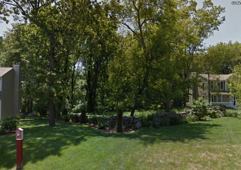
Cemetery Number
SK133
Town
SOUTH KINGSTOWN
Cemetery Name
FREEMAN P WATSON LOT
Find A Grave (Opens in New Tab)
Go to Find a Grave
Graves List
Display Graves List
Location
BIRCHWOOD DRIVE
State
RI
Direction
SW
Pole Number
Distance
40
Map Number
Page Number
Plat Number
Deed Book
Deed Page
Size in Feet
40
Size in Feet
80
Inscriptions
3
Fieldstones
0
Tombs
Exist?
YES
Last seen date?
2003
Newest
1860
Oldest
1831
Vandalism
N
Veteran
Pole
M
Comment
Located 40 feet southwest of Birchwood Drive between house #71 and House #59. The west wall is part of a long boundary stone wall. It is forty by eighty feet, in fair condition, enclosed with a stone wall. There is no historical cemetery sign. This cemetery has three large marble gravestones. This cemetery was recorded in 1935 by Charles and Martha Benns and again in 1979 by the Pettaquamscutt Historical Society. Both commented on heavy briar growth, but it has been cleared since the houses were built on each side of it. It was not recorded by James N. Arnold in 1880. Found, registered, and recorded by John Sterling & James Wheaton for a 2004 book on South Kingstown cemeteries.
Condition
fair
Enclosure
stone wall
Gate
no gate
Growth
overgrown-briars
Terrain
level
Cemetery Location
Cemetery Burial Map
ADDITIONAL CEMETERY PHOTOS/MAPS
 Photo/Image Courtesy of Rhode Island Historic Cemetery Volunteers