| Cemetery Number | SK121 |
| Town | SOUTH KINGSTOWN |
| Cemetery Name | BABCOCK-MARCHANT LOT |
| Find A Grave (Opens in New Tab) |
Go to Find a Grave
|
| Graves List | Display Graves List |
| Location | ROUTE #2 |
| State | RI |
| Direction | W |
| Pole Number | 93 |
| Distance | 900 |
| Map Number | |
| Page Number | |
| Plat Number | |
| Deed Book | |
| Deed Page | |
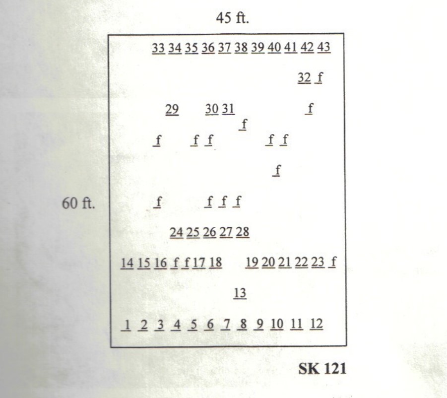
| Size in Feet | 60 |
| Size in Feet | 45 |
| Inscriptions | 45 |
| Fieldstones | 16 |
| Tombs | |
| Exist? | YES |
| Last seen date? | 2003 |
| Newest | 1999 |
| Oldest | 1803 |
| Vandalism | N |
| Veteran | |
| Pole | N |
| Comment | This cemetery is located nine hundred feet west of Route #2 at telephone pole #93. It is nearly opposite the road to Great Swamp fight monument, and it is five hundred feet southwest of the house at #3401 Route #2 in the middle of a hay field. There is evidence that a herd of deer rest inside of this cemetery. It is 60 feet x 45 feet, in good condition, enclosed with a stone wall, and no historical cemetery sign. There are 61 burials with 45 inscribed stones and 16 fieldstones.
James N. Arnold recorded this cemetery Nov. 9, 1880, his #231, “on land of William Marchant northwest of his house in open lot a burial yard of his family all with dark stones [slate] unless otherwise stated.” The cemetery was also recorded in 1933 by Charles and Martha Benns, their #194, but they thought it was in Richmond.
Found, registered, and recorded by John Sterling & James Wheaton for a 2004 book on South Kingstown cemeteries. |
| Condition | good |
| Enclosure | stone wall |
| Gate | no gate |
| Growth | cleared |
| Terrain | level |
| Cemetery Location |
|
| Cemetery Burial Map |
|
| |
|