Rhode Island Historical Cemeteries
Home
Members
Events
Meetings/Minutes
Database
FAQ/Documents
Links
Groups/Associations
Contact
FEATURED CEMETERY PHOTO
Photo/Image Courtesy of Rhode Island Historic Cemetery Volunteers
Cemetery Number
SK050
Town
SOUTH KINGSTOWN
Cemetery Name
SHERMAN LOT
Find A Grave (Opens in New Tab)
Go to Find a Grave
Graves List
Display Graves List
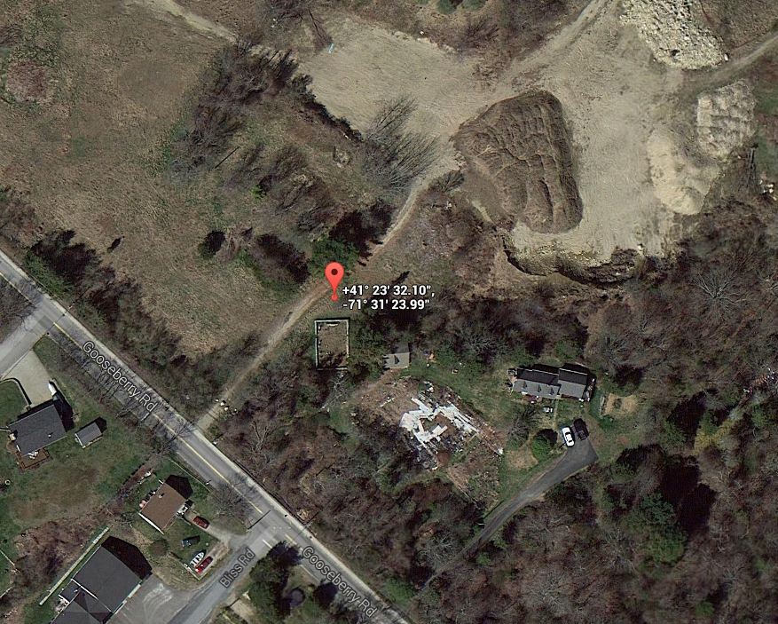
Location
GOOSEBERRY RD
State
RI
Direction
NE
Pole Number
16
Distance
140
Map Number
Page Number
Plat Number
Deed Book
Deed Page
Size in Feet
45
Size in Feet
30
Inscriptions
12
Fieldstones
0
Tombs
Exist?
YES
Last seen date?
2003
Newest
1944
Oldest
1832
Vandalism
N
Veteran
Pole
M
Comment
This cemetery is located 140 feet northeast of Gooseberry Road at telephone pole #16. It is at the house at #170 Gooseberry Road. It is 45 feet x 35 feet, in fair condition, enclosed with a stone wall with an iron gate, and the historical cemetery sign is missing. It contains fifteen burials with twelve inscribed stones and three fieldstones. In 2001 it was heavily overgrown. James N. Arnold visited this lot Oct. 16, 1880, his #185, “on land of John P. Sherman west of his house a burial yard granite posts with iron rails in good order.” Recorded by John Sterling and James Wheaton for a 2004 book on South Kingstown cemeteries.
Condition
fair
Enclosure
stone wall
Gate
iron gate
Growth
overgrown-trees
Terrain
level
Cemetery Location
Cemetery Burial Map
ADDITIONAL CEMETERY PHOTOS/MAPS
 Photo/Image Courtesy of Rhode Island Historic Cemetery Volunteers