| Cemetery Number | SK020 |
| Town | SOUTH KINGSTOWN |
| Cemetery Name | JOHN CLARKE JR LOT |
| Find A Grave (Opens in New Tab) |
Go to Find a Grave
|
| Graves List | Display Graves List |
| Location | CHERRY RD |
| State | RI |
| Direction | E |
| Pole Number | 5628 |
| Distance | 100 |
| Map Number | |
| Page Number | |
| Plat Number | |
| Deed Book | |
| Deed Page | |
| Size in Feet | 85 |
| Size in Feet | 80 |
| Inscriptions | 19 |
| Fieldstones | 37 |
| Tombs | |
| Exist? | YES |
| Last seen date? | 2003 |
| Newest | 1869 |
| Oldest | 1763 |
| Vandalism | N |
| Veteran | |
| Pole | |
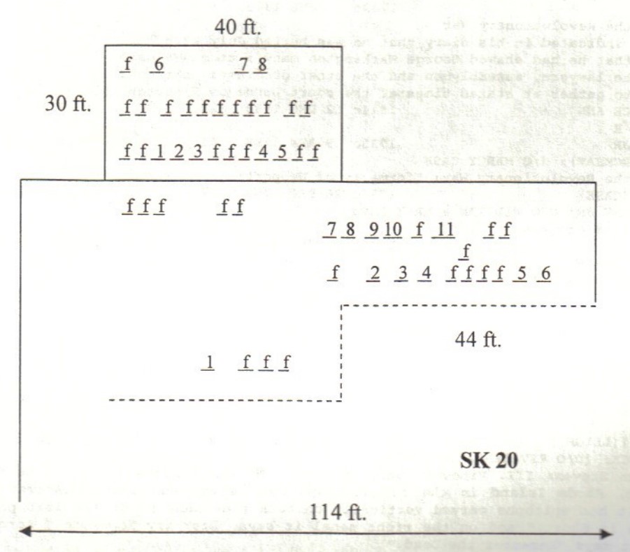
| Comment | This cemetery is one hundred feet east of Cherry Road at telephone pole # 5628. It is 85 feet x 80 feet, in good condition, enclosed with a stone wall with a wooden gate. There are 56 burials with 19 inscribed stones and 37 fieldstones.
James N. Arnold visited this lot Feb. 22, 1880, his #9, “the Clarke cemetery about 1/4 mile from corner of roads leading toward Mooresfield and Curtis Corner from Kingston.”
Craig Anthony surveyed this cemetery in 1995 just after a new stone wall was built on the south and east side of section “B.” Unfortunately this wall was built six feet into this cemetery on both sides. Section “B” (the smaller of the two, on the east side of section “A”) is now forty feet x thirty feet. Section “A” is 85 feet x 50 feet, and it contains twenty of the 37 fieldstone marked graves.
GPS coordinates (WGS84 datum): for section A, 41 28.547' x W 71 31.291', and for section B, 41 28.543' x W 71 31.282'.
Recorded by John Sterling and James Wheaton for a 2004 book on South Kingstown cemeteries. |
| Condition | good |
| Enclosure | stone wall |
| Gate | wooden gate |
| Growth | cleared |
| Terrain | level |
| Cemetery Location |
|
| Cemetery Burial Map |
|
| |
|