| Cemetery Number | SK014 |
| Town | SOUTH KINGSTOWN |
| Cemetery Name | GIDEON CLARKE LOT |
| Find A Grave (Opens in New Tab) |
Go to Find a Grave
|
| Graves List | Display Graves List |
| Location | LIBERTY LANE |
| State | RI |
| Direction | S |
| Pole Number | 9205 |
| Distance | 100 |
| Map Number | |
| Page Number | |
| Plat Number | |
| Deed Book | |
| Deed Page | |
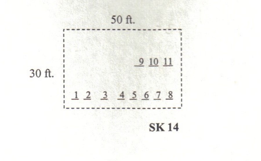
| Size in Feet | 30 |
| Size in Feet | 50 |
| Inscriptions | 11 |
| Fieldstones | 1 |
| Tombs | |
| Exist? | YES |
| Last seen date? | 2003 |
| Newest | 1901 |
| Oldest | 1817 |
| Vandalism | N |
| Veteran | 0 |
| Pole | M |
| Comment | Located one hundred feet south of Liberty Lane at telephone pole # 9205/80, this unenclosed cemetery is thirty feet by fifty feet, in fair condition, and the historical cemetery sign is missing. This cemetery is east of Route #2 and across Liberty Lane from the Stone House. To reach this cemetery, enter at the barway in a stone wall opposite NEL pole #9205/80, and go one hundred feet south. There are twelve burials, eleven marked by marble gravestones and one by a fieldstone.
James N. Arnold visited this yard Nov. 9, 1880, his #230, “on land of John G. Clarke southwest of his house on opposite side of road, yard slightly protected a burial yard of his family.”
Recorded by John Sterling and James Wheaton for a 2004 book on South Kingstown cemeteries. |
| Condition | fair |
| Enclosure | no enclosure |
| Gate | no gate |
| Growth | overgrown-trees |
| Terrain | level |
| Cemetery Location |
|
| Cemetery Burial Map |
|
| |
|