Rhode Island Historical Cemeteries
Home
Members
Events
Meetings/Minutes
Database
FAQ/Documents
Links
Groups/Associations
Contact
FEATURED CEMETERY PHOTO
Photo/Image Courtesy of Rhode Island Historic Cemetery Volunteers
Cemetery Number
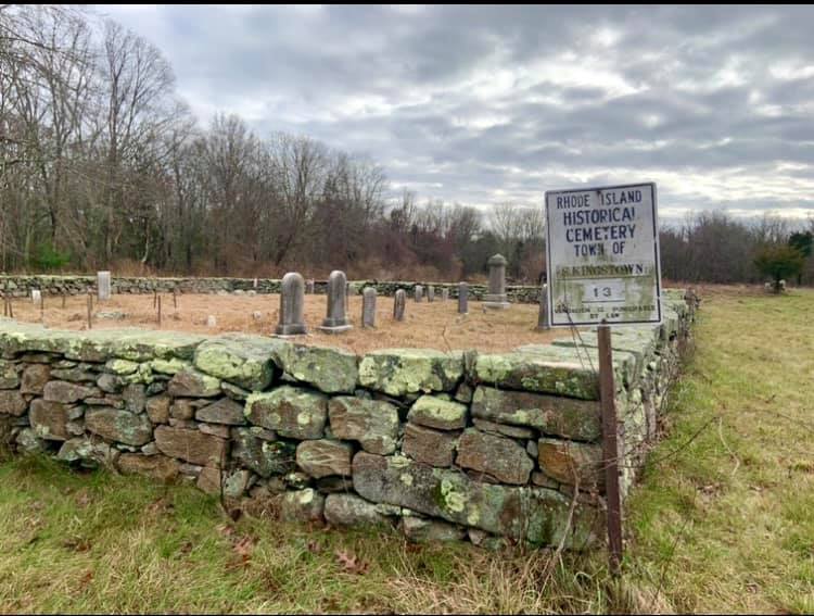
SK013
Town
SOUTH KINGSTOWN
Cemetery Name
BERIAH B GARDNER LOT
Find A Grave (Opens in New Tab)
Go to Find a Grave
Graves List
Display Graves List
Location
MOORESFIELD RD
State
RI
Direction
S
Pole Number
3514
Distance
600
Map Number
Page Number
Plat Number
Deed Book
Deed Page
Size in Feet
85
Size in Feet
80
Inscriptions
29
Fieldstones
10
Tombs
Exist?
YES
Last seen date?
2003
Newest
Oldest
Vandalism
N
Veteran
2
Pole
G
Comment
This cemetery is located six hundred feet south of Mooresfield Road, Route #138, at telephone pole #3514/27. It is 375 feet east of Wayside Meadow Road. It is west of the Fagnant driveway that runs south from Mooresfield Road in a field about one half a mile west of Tower Hill Road. It is 85 feet x 80 feet, in fair condition, enclosed with a stone wall with an iron gate. The historical cemetery sign is in good condition. There are 39 burials with 29 inscribed stones and ten fieldstones. James N. Arnold visited this lot May 16, 1880, his #99, “on land of Elisha G. Sherman’s heirs a distance southeast of the house in lot recently walled with double faces stone wall.” Recorded by John Sterling and James Wheaton for a 2004 book on South Kingstown cemeteries.
Condition
fair
Enclosure
stone wall
Gate
iron gate
Growth
cleared
Terrain
level
Cemetery Location
Cemetery Burial Map
ADDITIONAL CEMETERY PHOTOS/MAPS
 Photo/Image Courtesy of Rhode Island Historic Cemetery Volunteers