| Cemetery Number | SK002 |
| Town | SOUTH KINGSTOWN |
| Cemetery Name | QUEENS RIVER BAPTIST CEMETERY |
| Find A Grave (Opens in New Tab) |
Go to Find a Grave
|
| Graves List | Display Graves List |
| Location | ROUTE 138 |
| State | RI |
| Direction | N |
| Pole Number | 675 |
| Distance | 25 |
| Map Number | |
| Page Number | |
| Plat Number | |
| Deed Book | |
| Deed Page | |
| Size in Feet | 530 |
| Size in Feet | 155 |
| Inscriptions | 511 |
| Fieldstones | 0 |
| Tombs | 0 |
| Exist? | YES |
| Last seen date? | 2003 |
| Oldest | 1805 |
| Newest | 1988 |
| Enclosure | stone wall |
| Gate | chain |
| Terrain | level |
| Comment | This medium-sized Victorian cemetery is located 25 feet north of Route #138 at telephone pole # 675, next to the Queen’s River Baptist Church. It is two hundred feet by four hundred feet, in good condition, enclosed with a stone wall with a chain gate. The historical cemetery sign was in good condition at the time of our visit. There are about seven hundred burials with 511 inscribed stones.
James N. Arnold recorded this yard Nov. 18, 1880, his #252, “in the Usquepaug Cemetery a beautiful rural retreat surrounded by a good substantial wall, ground in good order a few evergreens are about the yard.” This transcript is located at the RI Historical Society, but it is incorrectly labeled as by George Harris.
Charles and Martha Benns recorded a few stones in this cemetery in 1939, their #854.
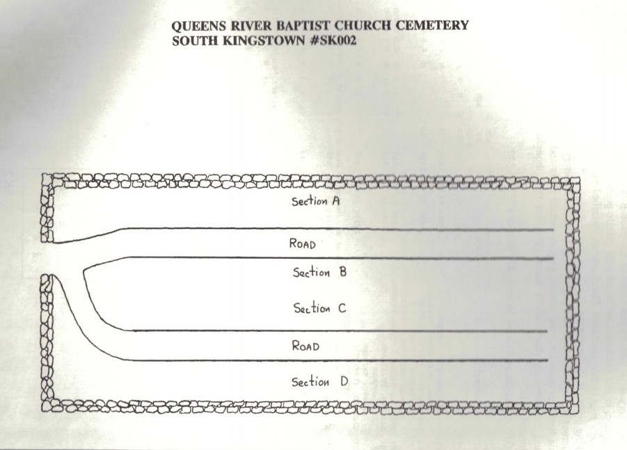
Sections A,B,C,D go front to back, from west to east.
Recorded by John Sterling and James Wheaton IN 1991 for a 2004 book on South Kingstown cemeteries.
Gravestones photographed in 2017 by Julie Nathanson. |
| Cemetery Location |
|
| Cemetery Burial Map |
|
| |
|