| Cemetery Number | SC183 |
| Town | SCITUATE |
| Cemetery Name | ASAHEL STEERE LOT |
| Find A Grave (Opens in New Tab) |
Go to Find a Grave
|
| Graves List | Display Graves List |
| Location | [REMOVED TO ROCKLAND CEMETERY] |
| State | RI |
| Direction | |
| Pole Number | |
| Distance | |
| Map Number | |
| Page Number | |
| Plat Number | |
| Deed Book | |
| Deed Page | |
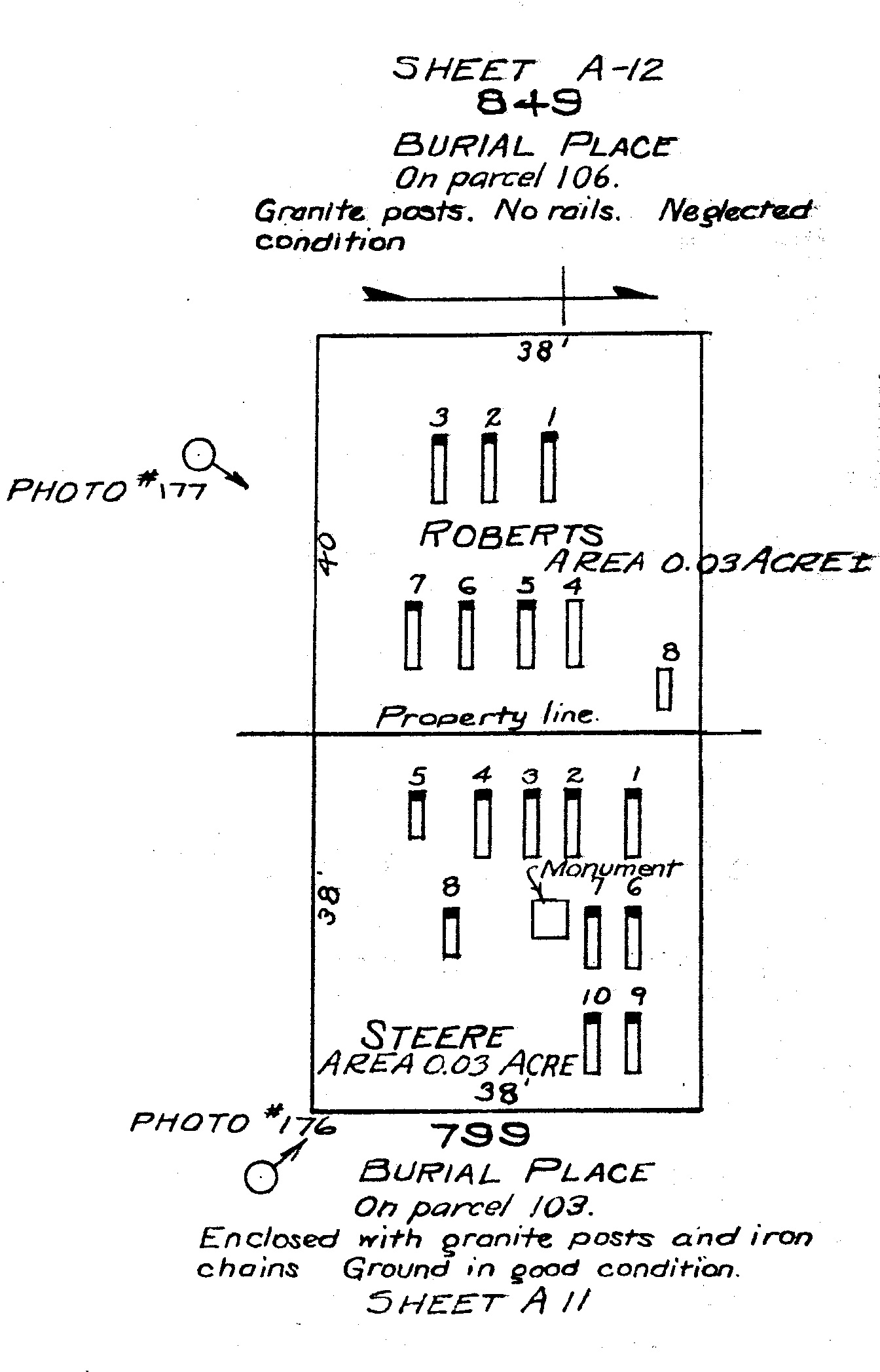
| Size in Feet | 38 |
| Size in Feet | 38 |
| Inscriptions | 9 |
| Fieldstones | |
| Tombs | |
| Exist? | NO |
| Last seen date? | 1917 |
| Newest | |
| Oldest | |
| Vandalism | |
| Veteran | |
| Pole | |
| Comment | reservoir map A11-#799; photo #176, adjacent to SC184, enclosed with
granite posts and iron chains. "On the Andrew Steere farm opposite the
Water Board's Scituate headquarters, and about 500 feet south of the
Plainfield Pike. Note taken June 24, 1915." "Andrew Steere, South Situate,
near river, perhaps could be consulted previous to removal of remains of
bodies."
James N Arnold recorded this lot 22 Oct 1904 (Vol 5, Pg 275) before it was
removed to make way for the reservoir. Opposite to the Baptist Meeting
House on the Plainfield Pike at So. Scituate and back of the hole burial
lot are two yards side by side, granite posts are set around both lots
(SC183 and SC184) but iron chains are only around the second, yards in good
order. adjacent to SC184.
approx. GPS coordinates 41 deg. 46.732' x 71 deg. 36.273' |
| Condition | |
| Enclosure | granite posts/iron rails |
| Gate | |
| Growth | |
| Terrain | |
| Cemetery Location |
|
| Cemetery Burial Map |
|
| |
|