Rhode Island Historical Cemeteries
Home
Members
Events
Meetings/Minutes
Database
FAQ/Documents
Links
Groups/Associations
Contact
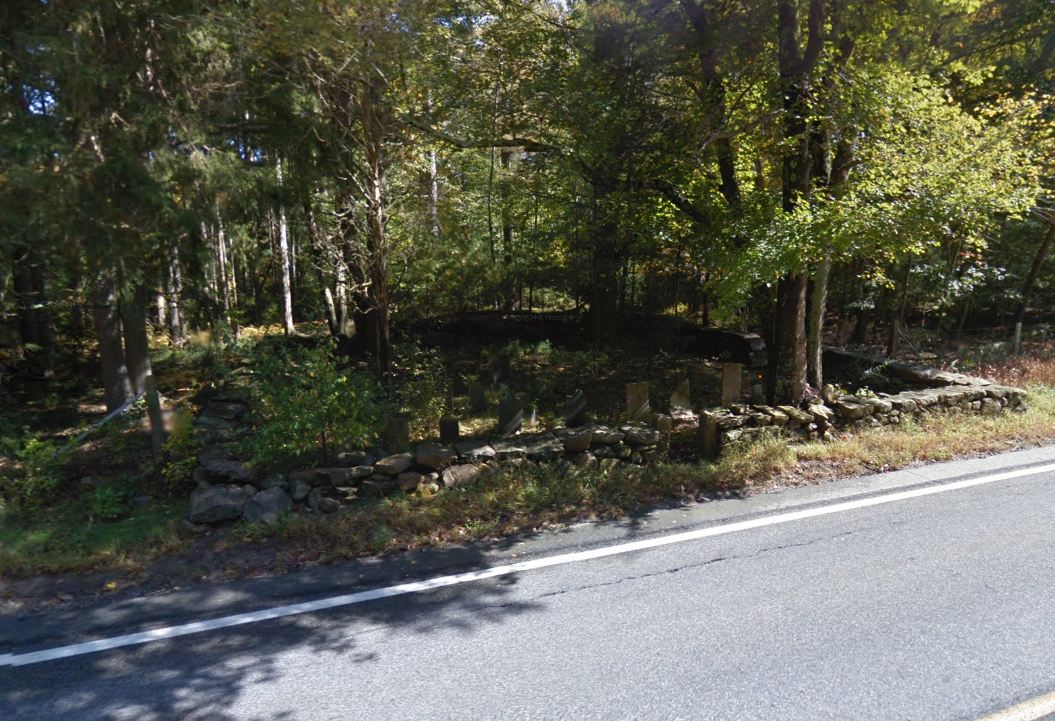
FEATURED CEMETERY PHOTO
Photo/Image Courtesy of Rhode Island Historic Cemetery Volunteers
Cemetery Number
SC048
Town
SCITUATE
Cemetery Name
JAMES ANDREWS LOT
Find A Grave (Opens in New Tab)
Go to Find a Grave
Graves List
Display Graves List
Location
ROUTE 116
State
RI
Direction
E
Pole Number
Distance
15
Map Number
Page Number
Plat Number
Deed Book
Deed Page
Size in Feet
50
Size in Feet
48
Inscriptions
15
Fieldstones
0
Tombs
Exist?
YES
Last seen date?
2013
Newest
1893
Oldest
1803
Vandalism
N
Veteran
2
Pole
M
Comment
Located beside East Road (Route #116) 1500 feet north of Waterman Drive. It is on the Water Supply property. Map A-5, 833 James Arnold recorded this lot 17 Oct 1904, Vol. 5, Pg. 124. "On the next farm south from Dea. Daniel Sweets beside the road a burial yard well walled but badly neglected."
Condition
good
Enclosure
stone wall
Gate
iron gate
Growth
cleared
Terrain
level
Cemetery Location
Cemetery Burial Map
ADDITIONAL CEMETERY PHOTOS/MAPS
 Photo/Image Courtesy of Rhode Island Historic Cemetery Volunteers