Rhode Island Historical Cemeteries
Home
Members
Events
Meetings/Minutes
Search Database
FAQ
Links
Groups/Associations
Contact
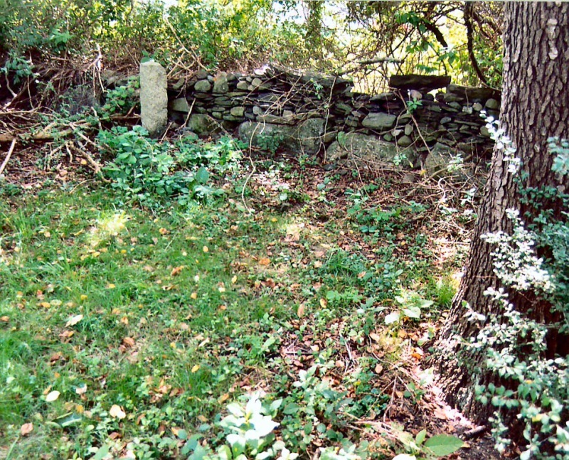
FEATURED CEMETERY PHOTO
Photo/Image Courtesy of Rhode Island Historic Cemetery Volunteers
Cemetery Number
PO054
Town
PORTSMOUTH
Cemetery Name
MCCURRIE LOT
Find A Grave (Opens in New Tab)
Graves List
Display Graves List
Location
VALLEY LANE
State
RI
Direction
Pole Number
Distance
Map Number
Page Number
Plat Number
Deed Book
Deed Page
Size in Feet
Size in Feet
Inscriptions
2
Fieldstones
Tombs
Exist?
YES
Last seen date?
2006
Oldest
1810
Newest
1817
Enclosure
granite posts/iron rails
Gate
no gate
Terrain
level
Comment
This cemetery is located 180 feet northeast of the loop on the end of Valley Lane. It is actually on the neighboring property at 338 East Main Road. It is 780 feet northeast of East Main Road. It is also 720 feet east of Route #24. "Rhode Island Tombstone Inscriptions" (ANON), circa 1900, at RIHS, gives a transcription of two McCurrie stones "on the Alanson Peckham farm now owned by Frederick Greene of Newport." George H. Richardson (GHR) visited this lot in 1903, read surname as CORRIE (Richardson Scrapbook 974 at NHS, p. 64). This is probably a lot for former slaves of Andrew McCorrie who were later freed. Was PO616 until located.
Cemetery Location
Cemetery Burial Map
N/A
ADDITIONAL CEMETERY PHOTOS/MAPS
 Photo/Image Courtesy of Rhode Island Historic Cemetery Volunteers