| Cemetery Number | NT009 |
| Town | NEWPORT |
| Cemetery Name | CODDINGTON BURIAL GROUND |
| Find A Grave (Opens in New Tab) |
Go to Find a Grave
|
| Graves List | Display Graves List |
| Location | FAREWELL ST |
| State | RI |
| Direction | W |
| Pole Number | 8 |
| Distance | 15 |
| Map Number | |
| Page Number | |
| Plat Number | |
| Deed Book | |
| Deed Page | |
| Size in Feet | 25 |
| Size in Feet | 150 |
| Inscriptions | 94 |
| Fieldstones | |
| Tombs | |
| Exist? | YES |
| Last seen date? | |
| Newest | |
| Oldest | 1647 |
| Vandalism | |
| Veteran | 6 |
| Pole | |
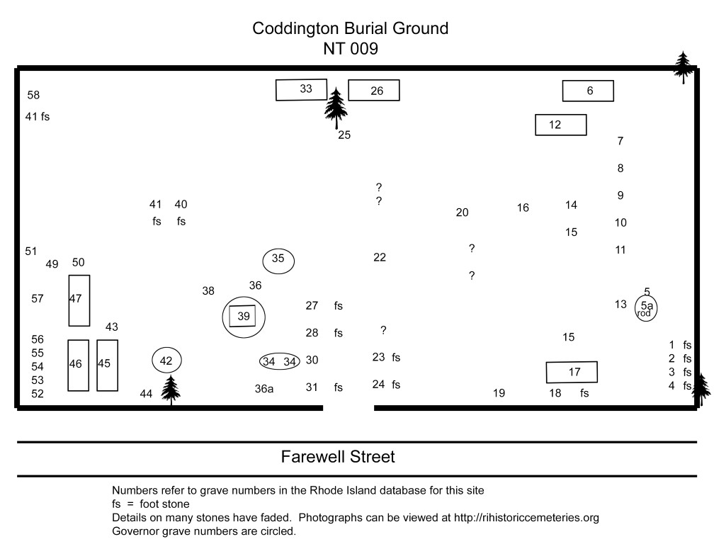
| Comment | On Farewell Street just south of N. Baptist St.
Recorded 14 Aug 1869 by G.H. Richardson (GHR) "all the legible inscriptions
in the Coddington Burying Ground, CETA volunteers in the 1970's, and also
by Alden G. Beaman (AGB) in the 1980's.
"History of Newport County, Rhode Island," New York, 1888, ed. Richard
M. Bayles, notes: "On Farewll street, near the First Baptist church, is the
Coddington ground. Here are the graves of Governors Henry Bull. Who died in
1693; Nicholas Easton, 1675; John Easton, 1705; and William Coddington,
1678---four of the original settlers of Newport. In this ground are buried
many of the first inhabitants."
A nice photograph of this cemetery appears in "The Architectural
Heritage of Newport, Rhode Island," showing the walls and relationship to
adjoining houses. The photo is captioned "Cemetery of Governors."
There is an 1873 transcript of this lot by William John Potts of
Camden, NJ at NEHGS that calls this the Old Graveyard of the North Baptist
Church.
GPS coordinates (WGS84 datum) 41 deg. 29' 32.91"N x 71 deg. 18' 51.79"W |
| Condition | |
| Enclosure | stone wall |
| Gate | |
| Growth | grass-well kept |
| Terrain | level |
| Cemetery Location |
|
| Cemetery Burial Map |

|
| |
|