Rhode Island Historical Cemeteries
Home
Members
Events
Meetings/Minutes
Database
FAQ/Documents
Links
Groups/Associations
Contact
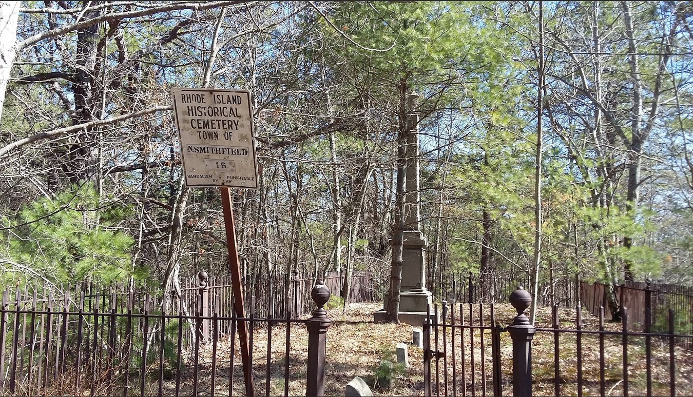
FEATURED CEMETERY PHOTO
Photo/Image Courtesy of Rhode Island Historic Cemetery Volunteers
Cemetery Number
NS016
Town
NORTH SMITHFIELD
Cemetery Name
JOSEPH NICHOLS LOT
Find A Grave (Opens in New Tab)
Go to Find a Grave
Graves List
Display Graves List
Location
DOUGLAS PIKE (ROUTE 7)
State
RI
Direction
S
Pole Number
158
Distance
235
Map Number
10
Page Number
10
Plat Number
159
Deed Book
89
Deed Page
112
Size in Feet
65
Size in Feet
25
Inscriptions
4
Fieldstones
Tombs
Exist?
YES
Last seen date?
2013
Newest
1919
Oldest
1848
Vandalism
N
Veteran
Pole
G
Comment
Located 235 feet south of Douglas Pike behind #65 half way between Douglas Pike and Tarklin Pond across from Pound Hill Road. Cemetery originally transcribed by Irene Nebiker in the early 1970's, it was re-surveyed by Roger Beaudry on November 19, 1994. Cemetery sits atop a small rise overlooking pond. Fence and gate are in good condition. Cemetery is in fair shape with very tall weeds growing within its borders. Cemetery is not shown in any land records located in the North Smithfield Town Hall. Transcribed by Ethel M White who describes it as: "Route 104 - turn and go to Spring Lake Road pass Pine Crest Lake, North Smithfield" Transcribed by Grace G Tillinghast Oct 8, 1930 (Vol 3, page 41). "Left handside of road to Nasonville. Enclosed lot with large monument." ****Note this lot is listed as a Burrillville cemetery by GGT. Transcribed by Ron Farrar circa 1970. "Junction of Douglas Pike, Mowry Road & Pound Hill Road."
Condition
fair
Enclosure
metal fence
Gate
iron gate
Growth
overgrown-weeds
Terrain
level
Cemetery Location
Cemetery Burial Map
ADDITIONAL CEMETERY PHOTOS/MAPS
 Photo/Image Courtesy of Rhode Island Historic Cemetery Volunteers