| Cemetery Number | NS015 |
| Town | NORTH SMITHFIELD |
| Cemetery Name | JOSEPH INMAN LOT |
| Find A Grave (Opens in New Tab) |
|
| Graves List | Display Graves List |
| Location | DOUGLAS PIKE (ROUTE 7) |
| State | RI |
| Direction | N |
| Pole Number | 138 |
| Distance | 10 |
| Map Number | 10 |
| Page Number | 10 |
| Plat Number | |
| Deed Book | |
| Deed Page | |
| Size in Feet | 55 |
| Size in Feet | 15 |
| Inscriptions | 4 |
| Fieldstones | 11 |
| Tombs | |
| Exist? | YES |
| Last seen date? | |
| Newest | 1846 |
| Oldest | 1844 |
| Vandalism | N |
| Veteran | |
| Pole | G |
| Comment | James N Arnold transcribed cemetery on April 24, 1908 and it is recorded in Volume 25, pages 290-291. It is listed under Smithfield. He describes cemetery as:
"On the Douglas Pike beside the road a distance West from the Field Station crossing, in the woods, lot not protected, overrun with brush."
Charles & Martha Benns transcribed cemetery between the years 1931-1935 and
lists this cemetery in Volume II page 226. They assigned #228 and described
it as:
"On Douglas Pike, 1 mile from Oak Valley, North Smithfield."
Ethel M White transcribed cemetery in 1930's. "North Smithfield-near Pine Crest Beach-left hand side of road on bank."
Irene Nebiker transcribed it in the early 1970's
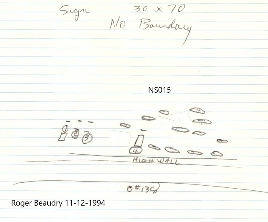
Roger Beaudry transcribed cemetery on November 12, 1994. It was in poor condition and completely overgrown with weeds and trees. 2 of the 4 inscribed stones were down. The lot has no visible boundaries, and the size was arrived at by measurements on record at North Smithfield Town Hall. This cemetery is recorded on the Plat plan, but it is located in two separate lots. (see map). Plat 10 Lot 132 is owned by Brian W & Hope M
Lagner by deed dated Dec 17, 1973, (Book 83 Page 1241). Plat 10 Lot 150 I owned by John Voccola by deed dated July 17, 1973 (Book 83, Page 213).
The cemetery sits atop a high wall, along the road.
Transcribed by Ron Farrar circa 1970. "Douglas Pike" |
| Condition | poor |
| Enclosure | no enclosure |
| Gate | no gate |
| Growth | overgrown-trees |
| Terrain | level |
| Cemetery Location |
|
| Cemetery Burial Map |
|
| |
|