Rhode Island Historical Cemeteries
Home
Members
Events
Meetings/Minutes
Database
FAQ/Documents
Links
Groups/Associations
Contact
FEATURED CEMETERY PHOTO
Photo/Image Courtesy of Rhode Island Historic Cemetery Volunteers
Cemetery Number
NK118
Town
NORTH KINGSTOWN
Cemetery Name
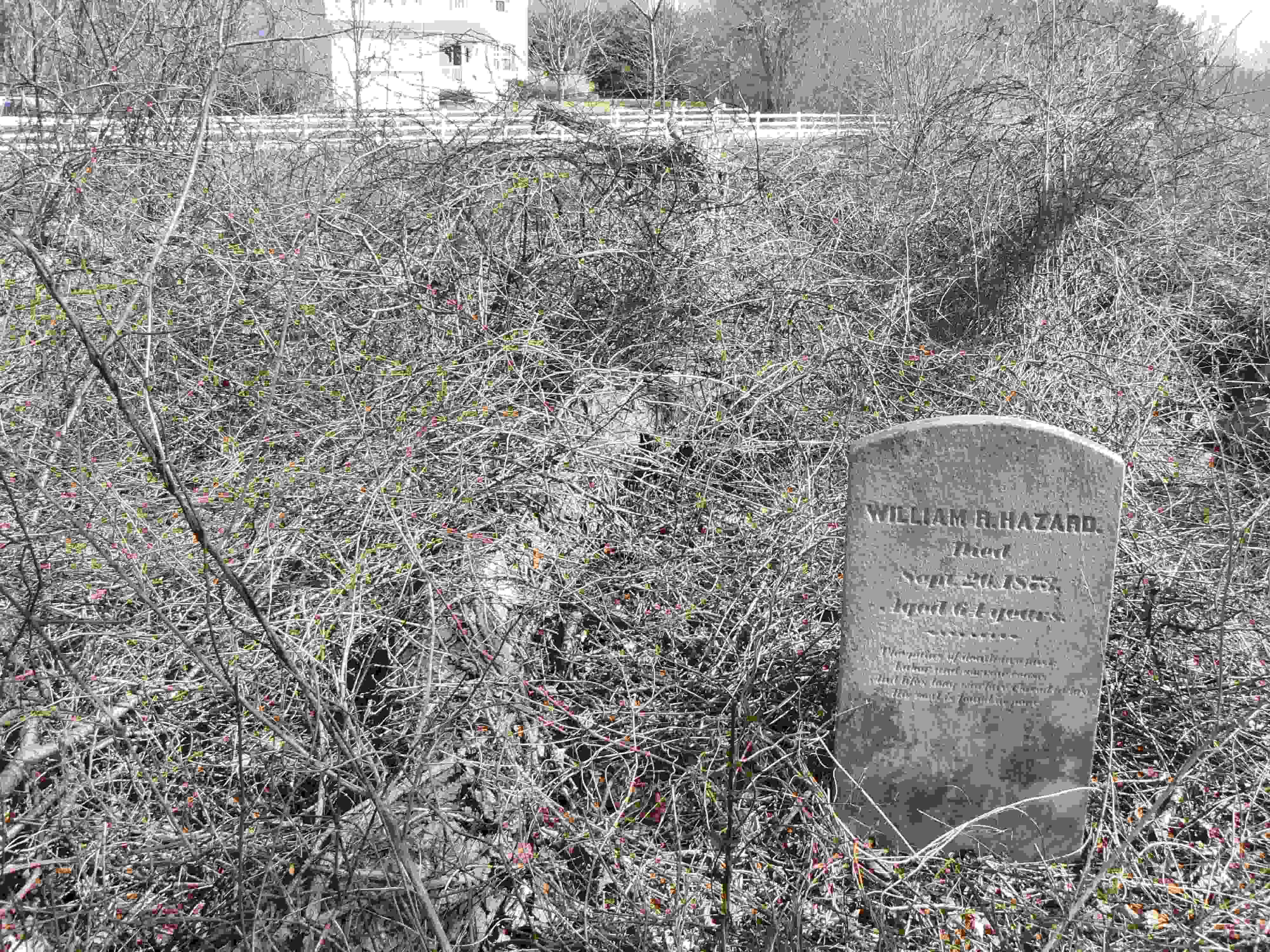
WILLIAM R HAZARD LOT
Find A Grave (Opens in New Tab)
Graves List
Display Graves List
Location
TOWER HILL ROAD
State
RI
Direction
W
Pole Number
Distance
Map Number
Page Number
14
Plat Number
2
Deed Book
Deed Page
Size in Feet
Size in Feet
Inscriptions
2
Fieldstones
13
Tombs
Exist?
YES
Last seen date?
2013
Newest
Oldest
Vandalism
Veteran
Pole
Comment
Located 90 feet southwest of Westmoreland Lane, and 1060 feet west of Tower Hill Road. There is a stone wall enclosed sitting area next to the road in front of the path to the cemetery. This was at one time on the Westmoreland Farm. Burgess called it Hazeldeane Farm. Burgess says this was known in 1938 as the Hazard Carson House. It was built in 1775 by Jonathan Hazard, torn down in 1940. Nameless graves are probably Hazards. Arnold on his visit 15 March 1880, his #23, placed it "on the land of Nathan Hazard, west of the farmhouse." He said it was walled with common boulders and overrun with weeds and brier. Unable to survey in 1990, permission denied by owner.
Condition
Enclosure
Gate
Growth
Terrain
Cemetery Location
Cemetery Burial Map
N/A
ADDITIONAL CEMETERY PHOTOS/MAPS
 Photo/Image Courtesy of Rhode Island Historic Cemetery Volunteers