Rhode Island Historical Cemeteries
Home
Members
Events
Meetings/Minutes
Database
FAQ/Documents
Links
Groups/Associations
Contact
FEATURED CEMETERY PHOTO
Photo/Image Courtesy of Rhode Island Historic Cemetery Volunteers
Cemetery Number
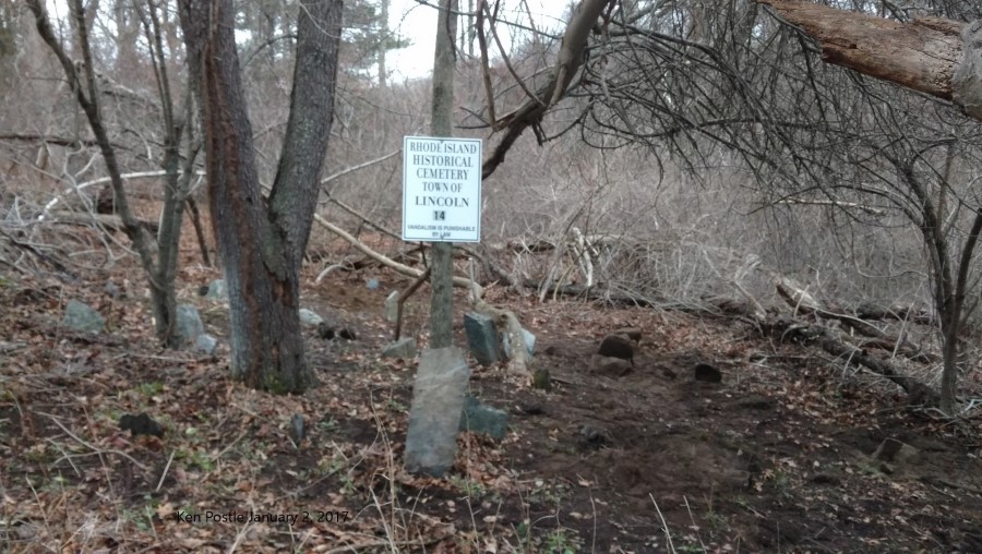
LN014
Town
LINCOLN
Cemetery Name
LYDIA HARRIS LOT
Find A Grave (Opens in New Tab)
Go to Find a Grave
Graves List
Display Graves List
Location
EDDIE DOWLING (RTE 146)
State
RI
Direction
E
Pole Number
Distance
250
Map Number
Page Number
Plat Number
Deed Book
Deed Page
Size in Feet
30
Size in Feet
20
Inscriptions
2
Fieldstones
30
Tombs
Exist?
YES
Last seen date?
2020
Newest
Oldest
Vandalism
N
Veteran
Pole
M
Comment
This cemetery is 250 feet east of Eddie Dowling Highway and 45 feet NE of Sherman Ave. Transcribed by Frank Calef, he describes location as: "Almost in Limerock. Just off the Louisquissett Pike on the road to Butterfly Factory." He assigned it #29. Its transcription is on page 102. Transcribed by Roger Beaudry on February 20, 1995. Its actual location is north of the intersection of Sherman Ave and Eddie Dowling Highway (Route 146). It is close to the brook which runs under Sherman Ave at this point. The original state listing of historical cemeteries listed this lot as unable to be found. Peter DiCola in his 1984 report listed this as #14. At the time of the Beaudry survey flourescent surveyor's tape outlined this lot. We were not able to be determined who did the survey.
Condition
fair
Enclosure
no enclosure
Gate
no gate
Growth
overgrown-weeds
Terrain
level
Cemetery Location
Cemetery Burial Map
ADDITIONAL CEMETERY PHOTOS/MAPS
 Photo/Image Courtesy of Rhode Island Historic Cemetery Volunteers