Rhode Island Historical Cemeteries
Home
Members
Events
Meetings/Minutes
Database
FAQ/Documents
Links
Groups/Associations
Contact
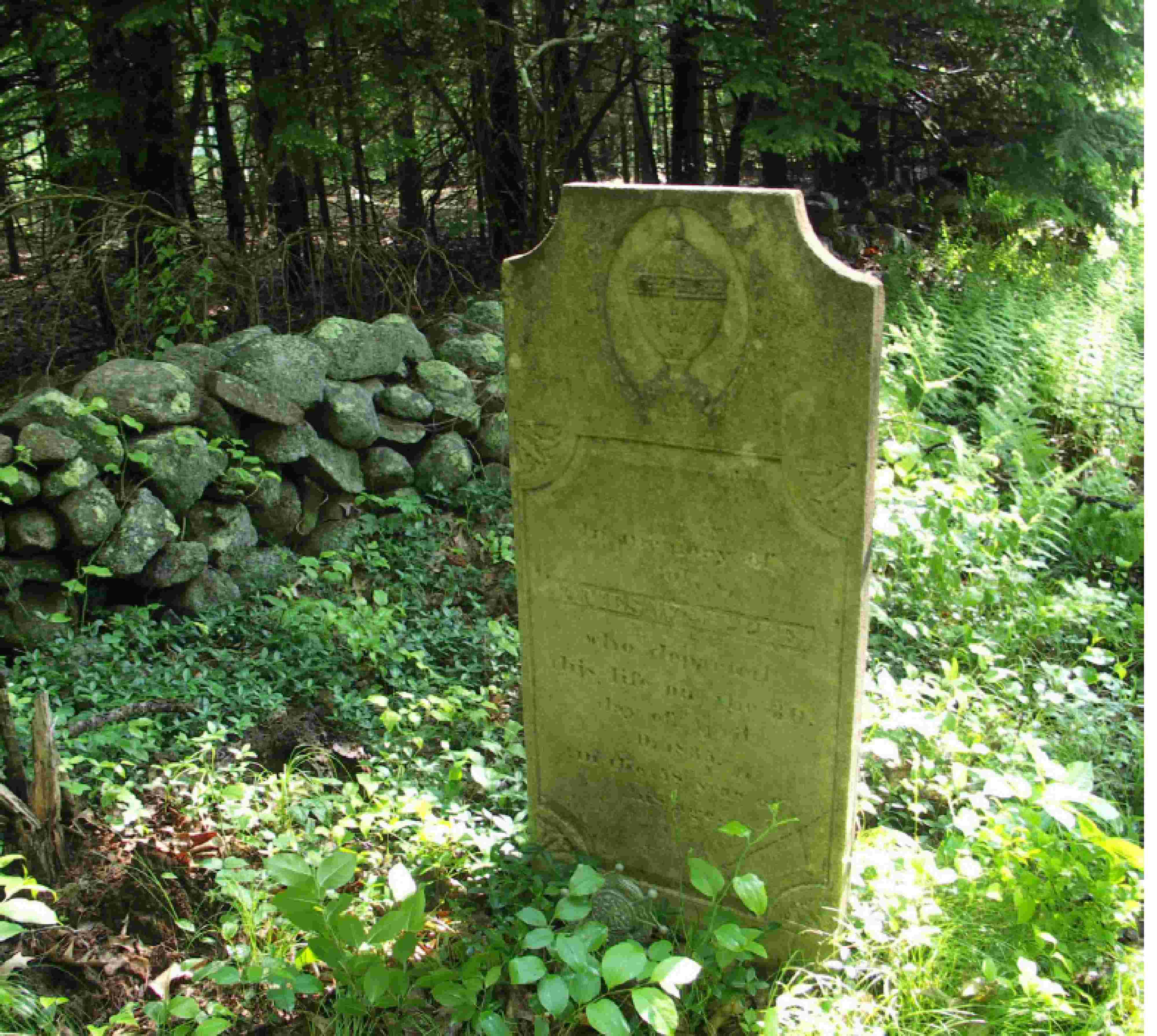
FEATURED CEMETERY PHOTO
Photo/Image Courtesy of Rhode Island Historic Cemetery Volunteers
Cemetery Number
FR147
Town
FOSTER
Cemetery Name
COL JAMES WHIPPLE LOT
Find A Grave (Opens in New Tab)
Go to Find a Grave
Graves List
Display Graves List
Location
WEATHERBEE ROAD
State
RI
Direction
W
Pole Number
Distance
500
Map Number
Page Number
Plat Number
Deed Book
Deed Page
Size in Feet
30
Size in Feet
30
Inscriptions
2
Fieldstones
Tombs
Exist?
YES
Last seen date?
Newest
1846
Oldest
1835
Vandalism
N
Veteran
Pole
N
Comment
From Central Pike enter Wetherbee Road and drive 1550 feet (about 0.3 mile) to a farm house on the west side (left). The cemetery is 550 feet northwest from the house. It is also 550 feet south of Central Pike behind #111 Central Pike. This house is directly across from Paris Olney Hopkins Road. Howard B Smith recorded this lot in 1937 West of Hygeia Road, [over covered bridge] 0.2 miles to Weatherbee Road. 0.3 miles to end of road to G A Weatherbee farm. The cemetery is 700 ft north of the house and 500 ft west of the road. Ford Hilton visited Walter Raymond Hohler the present owner of the Weatherbee farm in July 1998 and was told that the cemetery is there in the location described above.
Condition
good
Enclosure
stone wall
Gate
iron gate
Growth
cleared
Terrain
level
Cemetery Location
Cemetery Burial Map
N/A
ADDITIONAL CEMETERY PHOTOS/MAPS
 Photo/Image Courtesy of Rhode Island Historic Cemetery Volunteers