Rhode Island Historical Cemeteries
Home
Members
Events
Meetings/Minutes
Database
FAQ/Documents
Links
Groups/Associations
Contact
FEATURED CEMETERY PHOTO
Photo/Image Courtesy of Rhode Island Historic Cemetery Volunteers
Cemetery Number
FR141
Town
FOSTER
Cemetery Name
UNKNOWN LOT
Find A Grave (Opens in New Tab)
Graves List
Display Graves List
Location
RAMTAIL RD
State
RI
Direction
E
Pole Number
7
Distance
650
Map Number
Page Number
Plat Number
Deed Book
Deed Page
Size in Feet
60
Size in Feet
30
Inscriptions
0
Fieldstones
19
Tombs
Exist?
YES
Last seen date?
2020
Newest
Oldest
Vandalism
N
Veteran
Pole
G
Comment
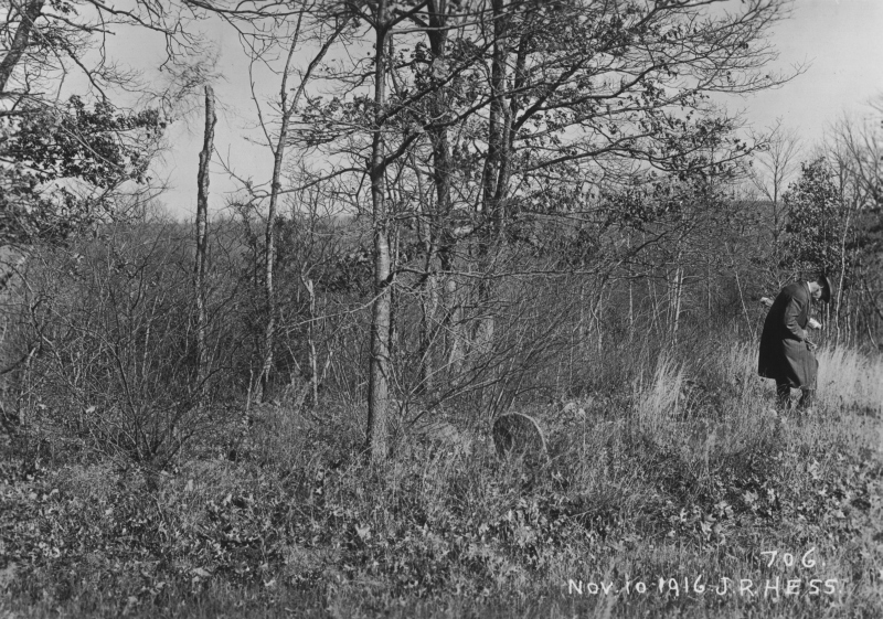
The photo was taken in 1916 when the Providence Water Board was getting ready to dam up the river to create the Scituate reservoir. This cemetery did not need to be moved, but it is on the restricted reservoir property. 0.3 mile from Central Pike. Enter red pine grove across the road from NE pole #7 on south side of wall and follow wall to end, continue on to white pine grove on a higher elevation. A brook which runs into the Reservoir is north of the stone wall, then curves slightly. Follow a faint foot path bearing left through the white pine. Follow path along ridge over brook and Reservoir to cemetery. On restricted reservoir property parcel 989, Photo #706
Condition
fair
Enclosure
no enclosure
Gate
no gate
Growth
overgrown-trees
Terrain
hilly moderate
Cemetery Location
Cemetery Burial Map
N/A
ADDITIONAL CEMETERY PHOTOS/MAPS
 Photo/Image Courtesy of Rhode Island Historic Cemetery Volunteers