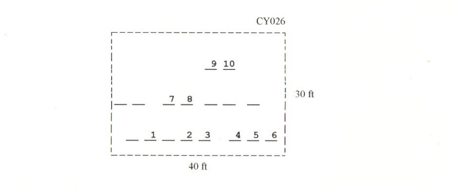
| Cemetery Number | CY026 |
| Town | COVENTRY |
| Cemetery Name | WICKES CEMETERY |
| Find A Grave (Opens in New Tab) |
|
| Graves List | Display Graves List |
| Location | VICTORY HIGHWAY |
| State | RI |
| Direction | E |
| Pole Number | 67 |
| Distance | 60 |
| Map Number | 316 |
| Page Number | |
| Plat Number | 132 |
| Deed Book | |
| Deed Page | |
| Size in Feet | 40 |
| Size in Feet | 30 |
| Burials | 17 |
| Inscriptions | 10 |
| Fieldstones | 7 |
| Tombs | 0 |
| Exist? | YES |
| Last seen date? | 2013 |
| Newest | 1877 |
| Oldest | 1800 |
| Vandalism | N |
| Veteran | 1 |
| Pole | N |
| Comment | The Wickes Cemetery is located 60 feet east of Victory Highway at telephone pole #67, across from #1315 Victory Highway. It is 40 ft x 30 ft, in fair condition, and has no enclosure. The historic cemetery sign is not installed yet. There are 17 burials with 10 inscribed stones and seven fieldstones. It is on the tax assessor’s map #316, lot #132.
James N. Arnold visited on 28 July 28 1905 and noted, “On knoll beside the railroad track at Summit, north side, not protected, some neglected. In sight of station” (Vol. 6, Book A, page 1087).
Charles and Martha Benns transcribed this lot in 1936, their #722.
Recorded by Dr. Bill Eddleman and John Sterling for a 1998 book on Coventry cemeteries |
| Condition | fair |
| Enclosure | no enclosure |
| Gate | no gate |
| Growth | overgrown-trees |
| Terrain | hilly steep |
| Cemetery Location |
|
| Cemetery Burial Map |
|
| |
|