Rhode Island Historical Cemeteries
Home
Members
Events
Meetings/Minutes
Database
FAQ/Documents
Links
Groups/Associations
Contact
FEATURED CEMETERY PHOTO
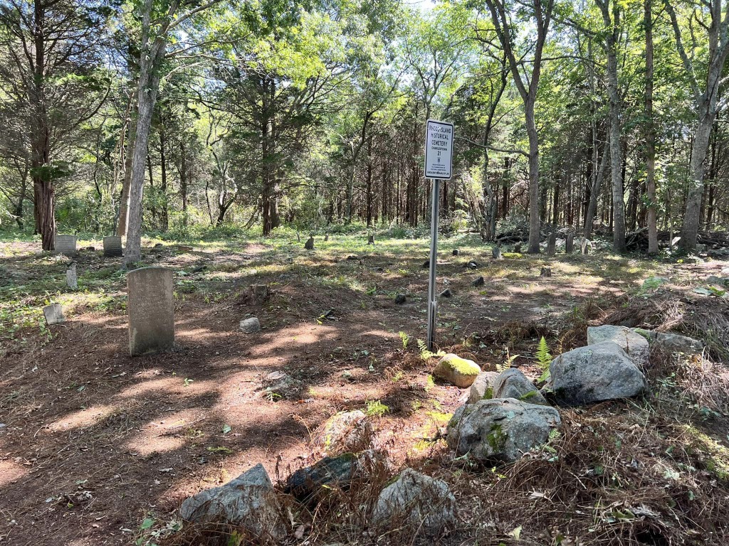
Photo/Image Courtesy of Rhode Island Historic Cemetery Volunteers
Cemetery Number
CH021
Town
CHARLESTOWN
Cemetery Name
CHAMPLIN - CHURCH LOT
Find A Grave (Opens in New Tab)
Graves List
Display Graves List
Location
POST RD - ROUTE #1
State
RI
Direction
SE
Pole Number
81
Distance
200
Map Number
7
Page Number
Plat Number
45
Deed Book
Deed Page
Size in Feet
100
Size in Feet
50
Inscriptions
6
Fieldstones
26
Tombs
Exist?
YES
Last seen date?
2013
Newest
1856
Oldest
1826
Vandalism
N
Veteran
0
Pole
F
Comment
Located 200 feet southeast of Post Road - Route #1 on the Ninigret Wildlife Refuge (formerly the Naval Auxillary Air Station and in the 1950s our drag strip). It is over the stone wall at pole 930, 50 ft in woods. Enter 400 ft west of where Prosser Trail intersects Route #1 at the telephone pole line south of Route #1. Stone wall on 3 sides (N,S,W). This is a favorite sunning location for black snakes. Recorded by Marjorie Pendleton about 1980 Recorded by John Sterling in 1993 Recorded by Lorraine Tarket-Arruda and Gayle Waite for their 2008 book on Charlestown cemeteries.
Condition
fair
Enclosure
stone wall
Gate
no gate
Growth
overgrown-trees
Terrain
level
Cemetery Location
Cemetery Burial Map
ADDITIONAL CEMETERY PHOTOS/MAPS
 Photo/Image Courtesy of Rhode Island Historic Cemetery Volunteers