| Cemetery Number | WK001 |
| Town | WARWICK |
| Cemetery Name | LAKEWOOD BURIAL GROUND |
| Find A Grave (Opens in New Tab) |
Go to Find a Grave
|
| Graves List | Display Graves List |
| Location | IRVING RD |
| State | RI |
| Direction | W |
| Pole Number | 4 |
| Distance | 75 |
| Map Number | |
| Page Number | 289 |
| Plat Number | 551 |
| Deed Book | |
| Deed Page | |
| Size in Feet | 100 |
| Size in Feet | 200 |
| Inscriptions | 35 |
| Fieldstones | |
| Tombs | |
| Exist? | YES |
| Last seen date? | 2013 |
| Newest | 1862 |
| Oldest | 1822 |
| Vandalism | YES |
| Veteran | 4 |
| Pole | M |
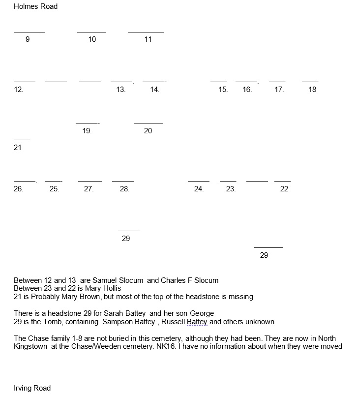
| Comment | This cemetery is 75 ft west of Irving Road at telephone pole #4. It is 100 ft x 200 ft, in fair condition, with no enclosure. The historic cemetery sign is missing. There were at least 32 burials with 29 inscribed stones and a tomb when Arnold recorded this lot in 1891. It is on the tax assessor’s map, Plat #289, Lot #551.
James Arnold visited this lot 10 Aug. 1891 and noted, “At Lakewood, north side of the Greenwich Road and west of the Warwick Branch Road, in plain sight of both, a burial yard showing neglect, both fence and yard” (Vol. 4, p. 87).
In 1994 this burial ground was almost totally destroyed, and most of the stones were missing. Only four gravestones were found: those for George and Sarah Battey (30), Martha Remington (11), Mary Coggeshall (18) and Corp Hollis Taber Jr. (22). Because of the destruction the natural order is impossible to determine. The map numbers that mark the natural order were derived from the Arnold transcript taken in 1891 when the cemetery was in better condition.
Recorded by John Sterling for a 1997 book on Warwick cemeteries. |
| Condition | fair |
| Enclosure | no enclosure |
| Gate | no gate |
| Growth | overgrown-trees |
| Terrain | hilly steep |
| Cemetery Location |
|
| Cemetery Burial Map |
|
| |
|