Cemetery Details
WK067 — GOV SAMUEL GORTON LOT
FEATURED CEMETERY PHOTO
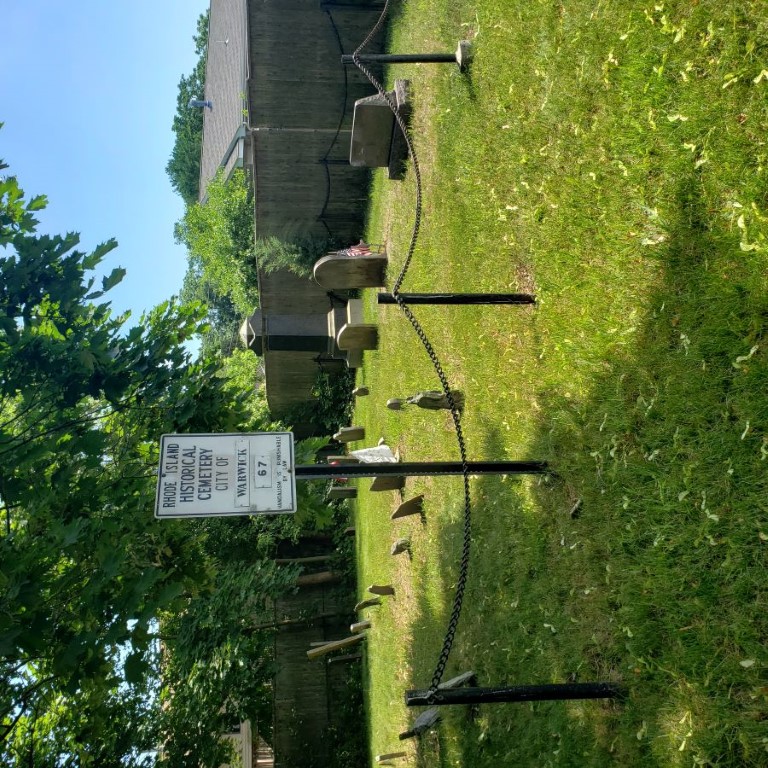 Photo/Image Courtesy of Rhode Island Historic Cemetery Volunteers
| Cemetery Number | WK067 |
| Town | WARWICK |
| Cemetery Name | GOV SAMUEL GORTON LOT |
| Find A Grave | Go to Find a Grave |
| Graves List | Display Graves List |
| Location | GORTON AVE ACROSS FROM ARMSTRONG AVE |
| State | RI |
| Direction | S |
| Pole Number | 7 |
| Distance | 100 |
| Map Number | |
| Page Number | 357 |
| Plat Number | 556 |
| Deed Book | |
| Deed Page | |
| Size in Feet | 50 |
| Size in Feet | 55 |
| Inscriptions | 13 |
| Fieldstones | 19 |
| Tombs | |
| Exist? | YES |
| Last seen date? | 2013 |
| Oldest | 1677 |
| Newest | 1981 |
| Enclosure | metal fence |
| Gate | no gate |
| Terrain | level |
| Comment | This lot is located 100 ft south of Gorton Avenue, across from Armstrong Avenue at telephone pole #7. It is 50 ft x 55 ft, in good condition, enclosed with iron posts with chains. The historic cemetery sign is in good condition. It contains 32 burials with 13 inscribed stones and 19 fieldstones. It is on the tax assessor’s map, Plat #357, Lot #556. James Arnold visited this lot 1 July 1894 and noted, “a few yards east of the Old Baptist Church, a burial yard in fine order” (Vol. 29, pp. 135-137). Recorded by John Sterling for a book on Warwick cemeteries. |
| Cemetery Location | |
| Cemetery Burial Map |
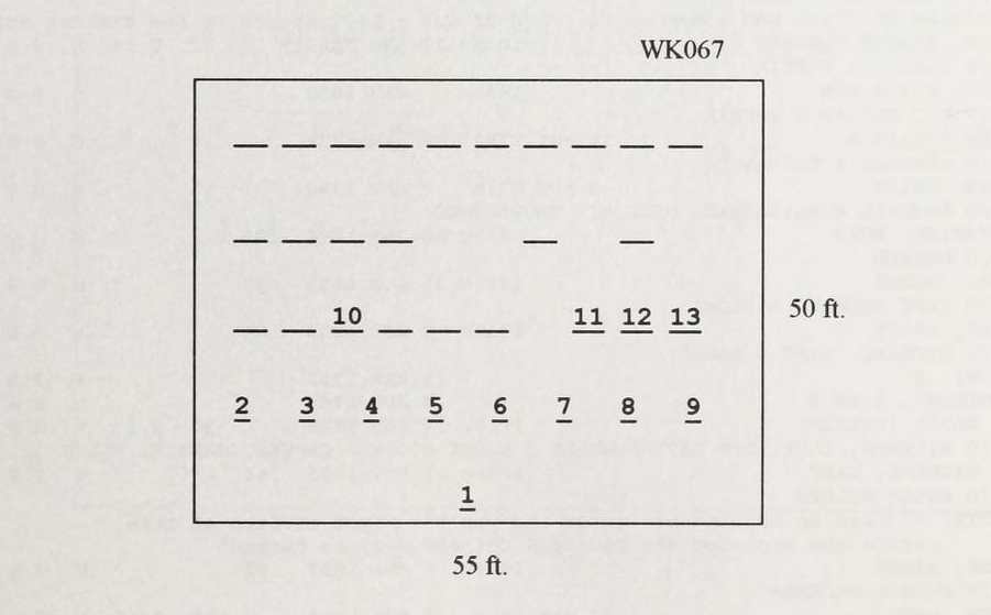 Click Cemetery Map for Enlarged Version.
Enlarged map will open in New Window. |