| Cemetery Number | CY174 |
| Town | COVENTRY |
| Cemetery Name | CHARLES JORDAN LOT |
| Find A Grave (Opens in New Tab) |
|
| Graves List | Display Graves List |
| Location | HOPKINS HOLLOW RD |
| State | RI |
| Direction | W |
| Pole Number | 86.75 |
| Distance | 3500 |
| Map Number | |
| Page Number | |
| Plat Number | |
| Deed Book | |
| Deed Page | |
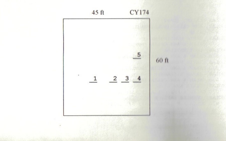
| Size in Feet | 45 |
| Size in Feet | 60 |
| Burials | 7 |
| Inscriptions | 7 |
| Fieldstones | 0 |
| Tombs | |
| Exist? | YES |
| Last seen date? | 2013 |
| Newest | 1889 |
| Oldest | 1837 |
| Vandalism | N |
| Veteran | 0 |
| Pole | N |
| Comment | This lot is located 3500 feet west of Hopkins Hollow Road at telephone pole #86 3/4. Enter the trail on the old railroad bed from Hopkins Hollow Road (telephone pole #86 3/4), and head west. After 1750 feet, a left hand bend turns straight. Go 1500 farther along this straight section. Just before the trail bends right, go into the woods heading north. There is a leaning telephone pole and a dead oak tree where you enter the woods. Go up a hill to the cemetery, which is at the southern edge of a flat area on top of the hill, 300 feet north of the railroad bed. The cemetery is 45 ft x 60 ft, in fair condition, and enclosed with a stone wall with an iron gate. There are five burials with five inscribed stones.
James N. Arnold visited on this cemetery on 10 Aug. 1905 and commented, “On the Jordan farm west of Greene Station, close to the railroad track south side of hill, yard walled and in good order. Yard growing up with white oak and shrubs” (Vol. 6, Book B, page 1160).
Found, registered and recorded by Dr. Bill Eddleman and John Sterling for a 1998 book on Coventry cemeteries. |
| Condition | fair |
| Enclosure | stone wall |
| Gate | iron gate |
| Growth | overgrown-trees |
| Terrain | hilly moderate |
| Cemetery Location |
|
| Cemetery Burial Map |
|
| |
|